
![]()
Itinerari TREKKING - EMILIA ROMAGNA
TREKKING routes - EMILIA ROMAGNA
TRK-EmiliaRomagna-002
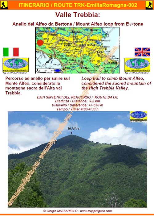
Valle Trebbia: Anello del Alfeo da Bertone
Trebbia Valley: Mount Alfeo loop from Bertone
DATA/DATE
Maggio 2015
May 2015
NOTE GENERALI / GENERAL NOTES
Percorso ad anello per salire sul Monte Alfeo, considerato la montagna sacra dell�Alta val Trebbia. Siamo ai margini del PARCO ANTOLA.
Loop trail to climb Mount Alfeo, considered the sacred mountain of the High Trebbia Valley. We are near PARCO ANTOLA.
DATI SINTETICI DEL PERCORSO / ROUTE DATA
Distanza / Distance: 9.2 km
Dislivello / Difference: +/-670 m
Tempo / Time: 4:00-4:30 h
LOCALITA' DI PARTENZA / STARTING PLACE
Il percorso inizia da Bertone, piccolo borgo nel comune di Ottone (PC).
The route starts at Bertone, a small village in the municipality of Ottone (PC).
COME ARRIVARE / HOW TO REACH STARTING PLACE
![]() Da Genova: dall�uscita del casello di Ge-Est dell�autostrada A12 prendiamo a
sinistra e procediamo in direzione di Piacenza. Percorriamo tutta la strada
statale n.45 fino a Gorreto.
Da Genova: dall�uscita del casello di Ge-Est dell�autostrada A12 prendiamo a
sinistra e procediamo in direzione di Piacenza. Percorriamo tutta la strada
statale n.45 fino a Gorreto.
Da Piacenza: dall�uscita di Piacenza Ovest dell�autostrada A21 prendiamo
la tangenziale di Piacenza e poi deviamo a destra per Bobbio e Genova.
Seguiamo la strada statale n.45 fino a Gorreto.
Da Gorreto si entra nella piazza del paese e si prende la strada per Barchi.
Si raggiunge il borgo di Barchi e poco dopo si devia a destra per Bertone
che si raggiunge poco dopo (qualche posteggio prima del paese).
From Genoa: from the exit of Ge-Est of the A12 motorwayt, we turn left and
proceed in the direction of Piacenza. We travel across the highway 45, up to Gorreto.
From Piacenza: from the exit of Piacenza-Ovest of A21 motorway,
we take the ring road of Piacenza and then we turn off to the right
to Bobbio and Genoa. We follow the main road n.45 until Gorreto.
From Gorreto we enter in the town square and take the road to Barchi.
We reach the village of Barchi and shortly after we turn off to
the right to Bertone, which we reach shortly after (some car park before the village).
PERIODO / WHEN TO GO
Da primavera ad autunno inoltrato.
Durante l�inverno con copertura nevosa e' un percorso da fare con le ciaspole.
From spring to late autumn.
During the winter with snow cover is a path to do with snowshoes.
DIFFICOLTA' / DIFFICULTIES
Secondo la scala CAI: E (Escursionistica)
Il percorso si svolge su sentieri segnalati.
![]()
According to CAI classification: E (for Normal Hiker).
The whole route runs on easy paths, always marked.
SCHEDA PERCORSO / ROAD-BOOK
LIBRETTO DI 10 PAGINE CON TUTTI I DATI PER EFFETTUARE L'ITINERARIO
BOOKLET OF 10 PAGES WITH INSIDE ALL INFOMATIONS TO MAKE THE ROUTE
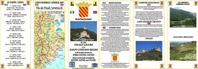
CARTE DI DETTAGLIO / DETAILED MAPS
Per raggiungere la localita' di partenza e' utile utilizzare la seguente tavola della
collana mini MAPPE CAR
To reach starting places is useful following
mini MAPPE CAR type map
Sei interessato alle CARTE DI DETTAGLIO di questo percorso?
CONTATTAMI
Are you interested about DETAILED MAPS of this route?
WRITE ME
QUALCHE FOTO / SOME PICTURES
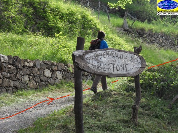
Presso Bertone, all'inizio del percorso
At Bertone, where it begins the path
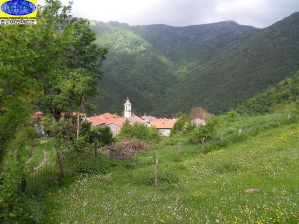
Bertone
Bertone
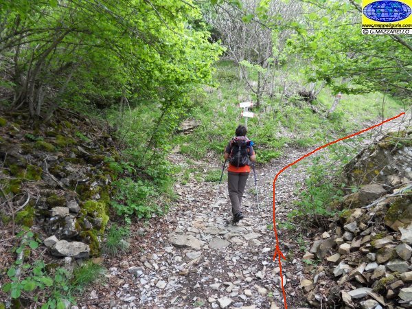
Presso il primo bivio dove prendiamo a destra per Ottone
At the first junction where we turn right towards Ottone
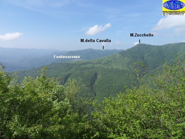
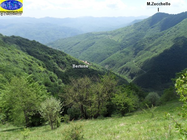
Panorama sul Monte Zucchello e sull'Altopiano della Cavalla
Panorama on Mount Zucchello and on the plateau of the Cavalla
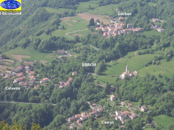
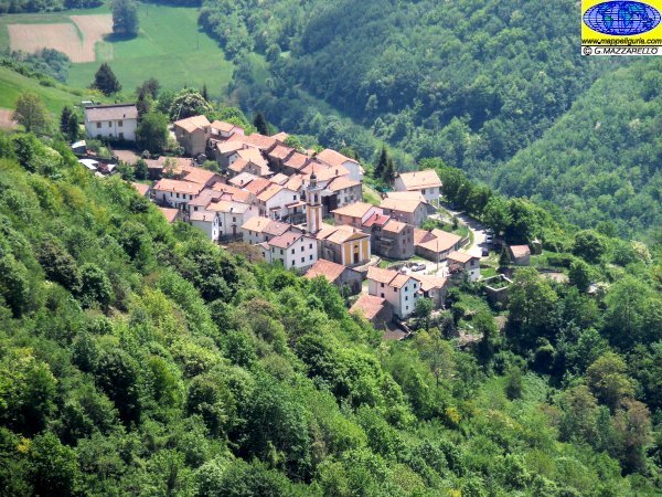
Panorama sui tre borghi di Barchi
Panorama over three villagee of Barchi
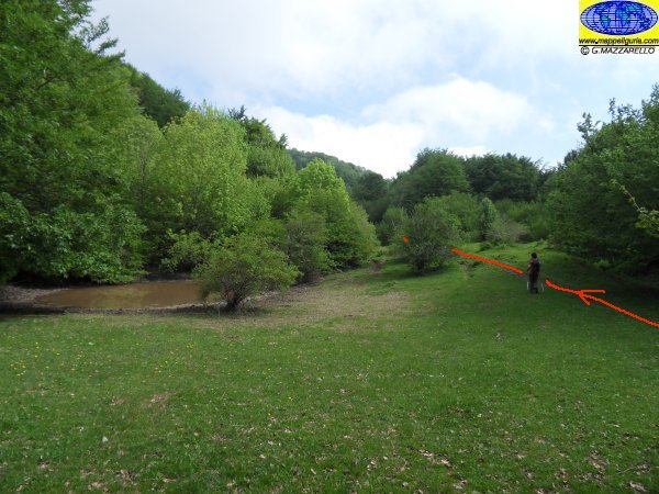
Presso l'area prativa poco prima di iniziare la salita nel versante est del Monte Alfeo
At the grassy area just before starting the climb in the eastern slopes of Monte Alfeo
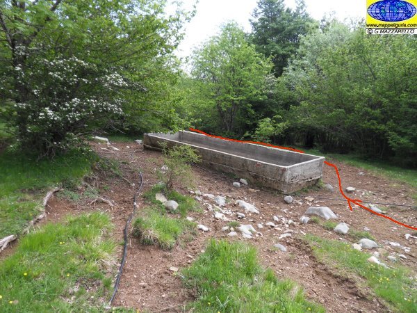
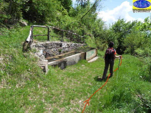
Il grosso abbeveratoio per bestiame che incontriamo prima di iniziare la salita nel versante est del Monte Alfeo
The big water trough for cattle that we meet before starting the climb in the eastern slopes of Monte Alfeo
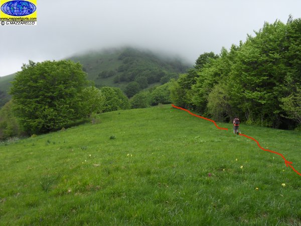
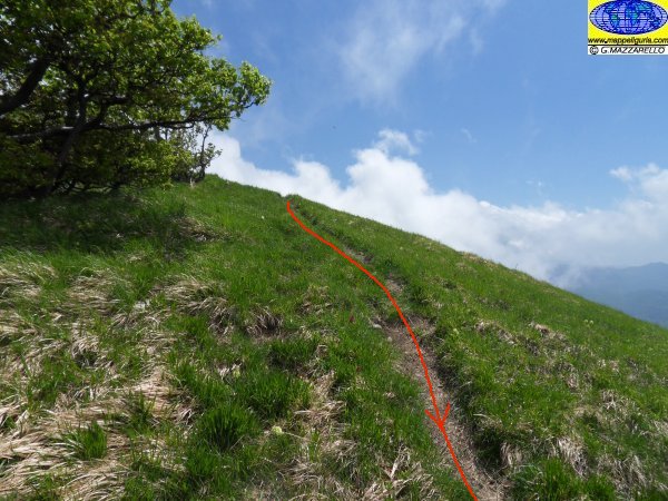
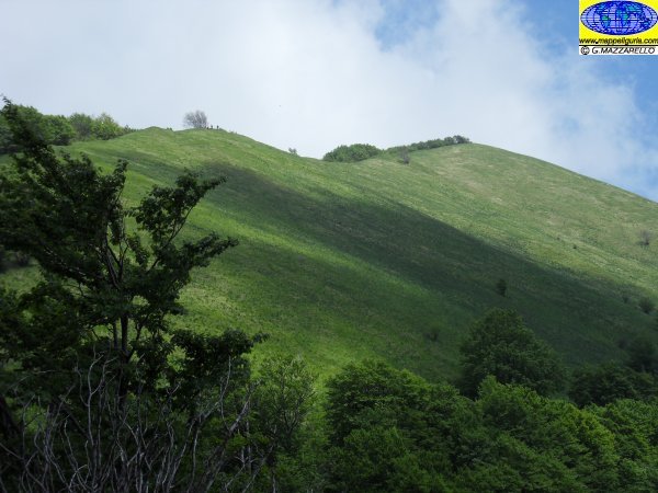
Salendo lungo il versante est del Monte Alfeo
Going up along the east side of Monte Alfeo
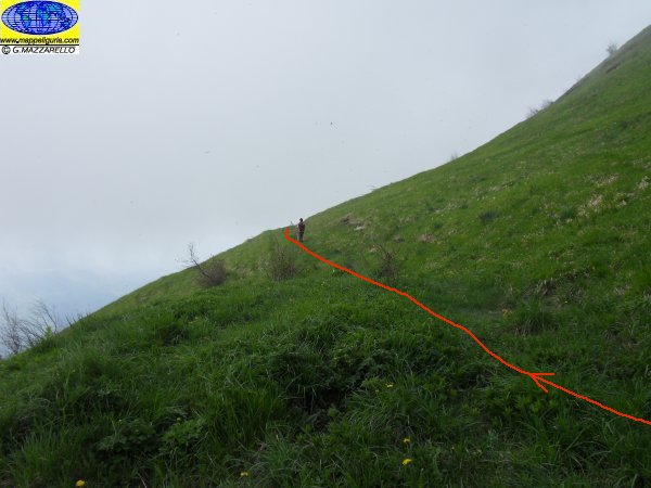
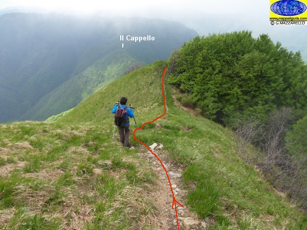
Salendo verso la vetta prima dell'ultimo bivio
Going up to the peak before the last crossroads
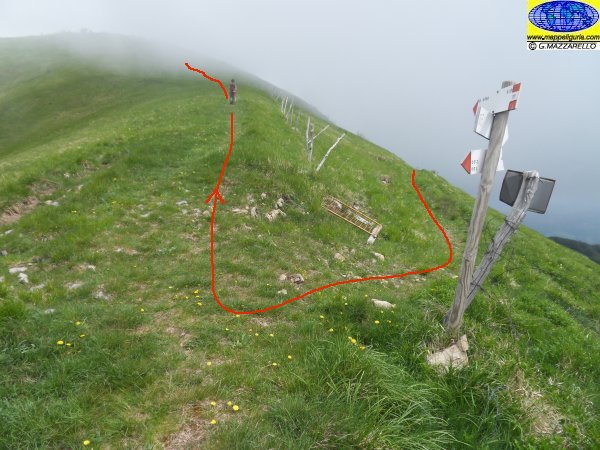
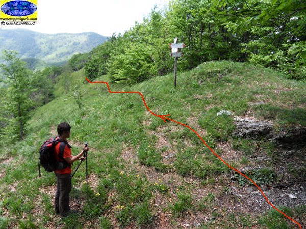
Presso il bivio sul costone sud del Monte Alfeo
At the crossroads on the ridge south of Monte Alfeo
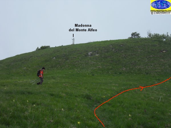
Poco prima della vetta del Monte Alfeo
Just before the summit of Mount Alfeo
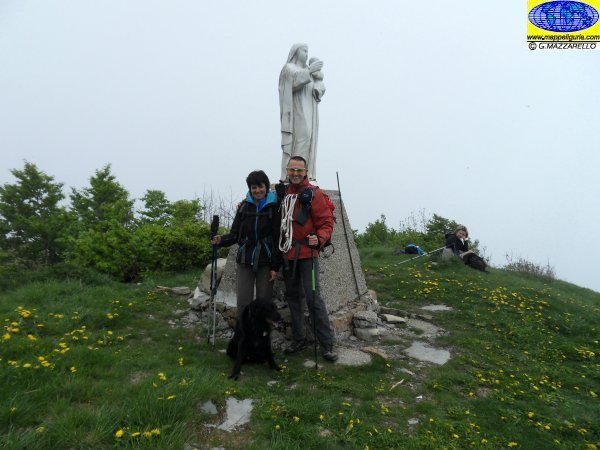
Presso la statua della Madonna sulla vetta del Monte Alfeo
Summit of Mount Alfeo
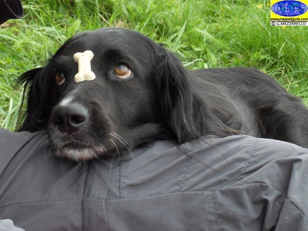
Una pausa presso la vetta in attesa del biscotto
A break at the summit waiting for cookie
Il costone ovest del Monte Alfeo
The ridge west of Monte Alfeo
Scendendo lungo il costone ovest del Monte Alfeo
Going down along the ridge west of Monte Alfeo
Presso il Valico del Monte Alfeo
At the Pass of Monte Alfeo
Panorama sulla valle di Bertone
Panorama over Bertone valley
Panorama sul costone ovest del Monte Alfeo
Panorama of the ridge west of Monte Alfeo
Panorama su Bertone
Panorama of Bertone
Lungo il sentiero poco prima di Bertone
Along the path just before Bertone
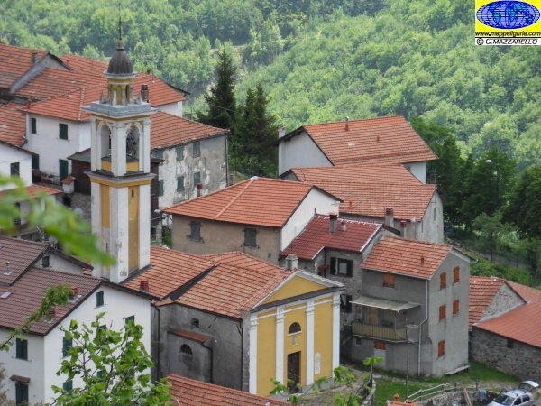
Panorama sulla chiesa di Bertone
Panorama over Bertone church
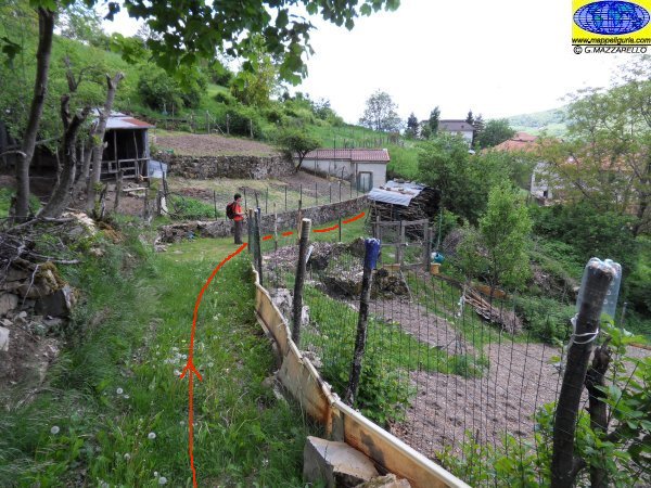
Lungo il sentiero poco prima di Bertone
Along the path just before Bertone
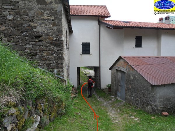
Tra le case di Bertone
Between the houses of Bertone
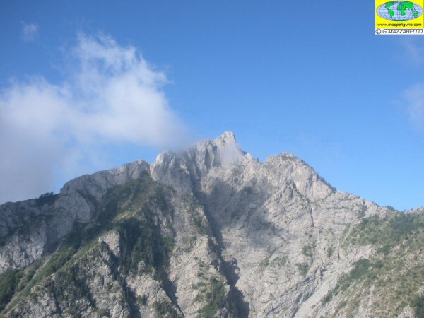
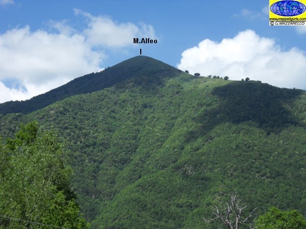
Panorama sul Monte Alfeo
Panorama of Monte Alfeo
NOTE /NOTICE
Pur avendo prestato la massima attenzione nella stesura della descrizione del percorso, a causa della mutevolezza del territorio, della variabilita' delle condizioni meteo e di eventuali errori od imprecisioni o giudizi soggettivi indicati nel presente testo, l'autore declina ogni responsabilita' per eventuali incidenti che potrebbero verificarsi. Chi desidera effettuare questo percorso lo fa a proprio rischio e pericolo.
In the description of the route I have done the greatest care, but because of the changing nature of the area, the variability of weather conditions and any errors or inaccuracies or subjective judgments referred to in this text, the author disclaims all responsibility for any accidents that may occur. Those wishing to go this route you do so at your own risk.
Chiunque desiderasse avere maggiori informazioni su questo itinerario, mi
puo' contattare.
Do you want more information about this route?
Please write me
