
![]()
Itinerari TREKKING - Provincia di Genova
TREKKING routes - Genova district
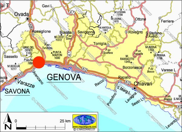
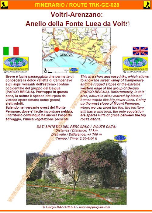
TRK-GE-028 Voltri-Arenzano: Anello della Fonte Luea da Voltri
DATA/DATE
Aprile 2008
April 2008
NOTE GENERALI / GENERAL NOTES
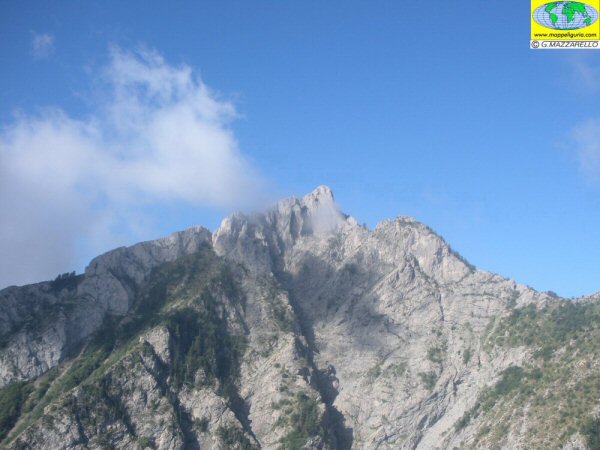
Breve e facile passeggiata che permette di conoscere la dolce valletta di Campenave e gli aspri versanti dell�estremo confine occidentale del gruppo del Beigua (PARCO DEL BEIGUA). Purtroppo in questa zona, la natura � spesso deturpata da vistose opere umane come grossi elettrodotti. Salendo nel versante ovest del Monte Pennone, dove e� facile incontrare nebbia, il territorio comunque ha ancora l�aspetto selvaggio, l�unica vegetazione presente sono i radi ciuffi d�erba che riescono a trovare spazio tra le grosse rocce detritiche.
This is a short and easy hike, which allows to know the sweet valley of Campenave and the rugged slopes of the extreme western edge of the group of Beigua (PARCO DEL BEIGUA). Unfortunately, in this area, nature is often marred by blatant human works like big power lines. Going up the west slope of Mount Pennone, where we can meet the fog, the territory still has a wild look, the only vegetation are sparse tufts of grass between the big rocks debris.
DATI SINTETICI DEL PERCORSO / ROUTE DATA
Distanza / Distance: 11 km
Dislivello / Difference: +/-700 m
Tempo / Time: 3:30-4:00 h
LOCALITA' DI PARTENZA / STARTING PLACE
Si parte da Voltri, estrema frazione occidentale di Genova (GE).
The route begins at Voltri, extreme western hamlet of Genova (GE).
COME ARRIVARE / HOW TO REACH STARTING PLACE
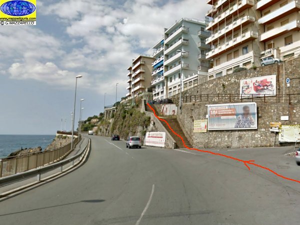
![]() Dal casello di Ge-Voltri dell�autostrada A10 prendiamo a destra per Arenzano e Voltri.
Attraversiamo Voltri e poco prima del ponte sul Cerusa lasciamo l'auto presso
il parcheggio a sinistra e proseguiamo a piedi per 200 m fino al ponte
sul torrente Cerusa (capolinea del Bus).
Dal casello di Ge-Voltri dell�autostrada A10 prendiamo a destra per Arenzano e Voltri.
Attraversiamo Voltri e poco prima del ponte sul Cerusa lasciamo l'auto presso
il parcheggio a sinistra e proseguiamo a piedi per 200 m fino al ponte
sul torrente Cerusa (capolinea del Bus).
From the exit of Ge-Voltri, of the A10 motorway, we take the right to Arenzano and Voltri. We cross Voltri and just before the bridge on Cerusa leave the car at the parking lot on the left, and we continue on foot for 200 m to reach the bridge over the Creek Cerusa (Bus terminal).
PERIODO / WHEN TO GO
Tutto l�anno.
Da evitare la piena estate per il caldo.
Throughout all the year.
Avoid the summer, because of the heat.
DIFFICOLTA' / DIFFICULTIES
Secondo la scala CAI: T-E (Turistica-Escursionistica).
Il percorso si svolge interamente su asfaltate, sterrate e facili sentieri sempre segnalati.
![]()
According to CAI classification: T-E (For Tourist - For Normal Hiker).
The route is entirely on paved, unpaved and easy foot-paths always marked.
SCHEDA PERCORSO / ROAD-BOOK
LIBRETTO DI 10 PAGINE CON TUTTI I DATI PER EFFETTUARE L'ITINERARIO
BOOKLET OF 10 PAGES WITH INSIDE ALL INFOMATIONS TO MAKE THE ROUTE
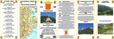
CARTE DI DETTAGLIO / DETAILED MAPS
Tutto il percorso descritto e' contenuto nelle seguenti tavole della collana
mini MAPPE OUTDOOR ACTIVITIES
This route is showed on following
mini MAPPE OUTDOOR ACTIVITIES type maps
Per raggiungere la localita' di partenza e' utile utilizzare la seguente tavola della
collana mini MAPPE CAR
To reach starting places is useful following
mini MAPPE CAR type map
Sei interessato alle CARTE DI DETTAGLIO di questo percorso?
CONTATTAMI
Are you interested about DETAILED MAPS of this route?
WRITE ME
QUALCHE FOTO / SOME PICTURES
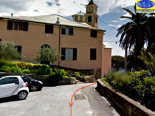
Presso Voltri all'inizio del percorso
Voltri at the beginning of the route
Presso la chiesa di Crevari
Crevari church
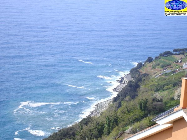
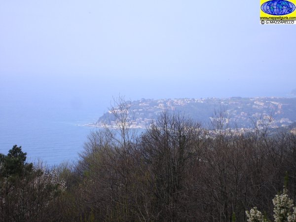
Panorama sulla costa sotto al borgo di Crevari
View of the coast below the village of Crevari
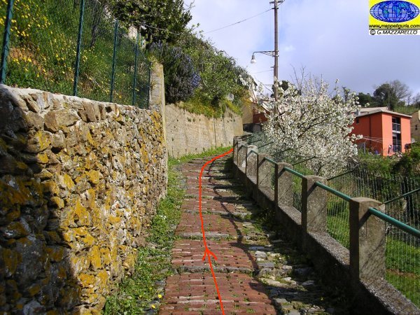
Lungo la mattonata verso la sella del Bric Campenave
Along the brick path to the saddle of the Bric Campenave
Presso l'Agriturismo Pietre Turchine
At Agriturismo Pietre Turchine
Panorama verso Arenzano
Panorama of Arenzano
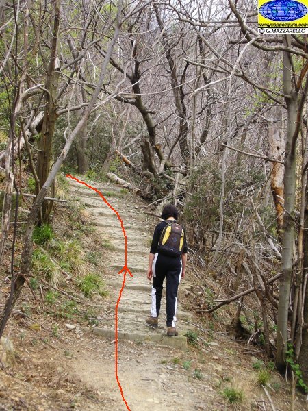
Lungo il sentiero
Along path
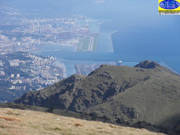
Panorama su Genova
Panorama of Genova
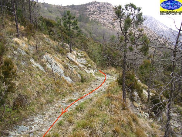
Lungo la sterrata che scende verso la Fonte Luea
Along the dirt road toward the Source Luea
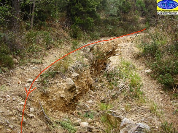
Lungo la sterrata che scende verso la Fonte Luea
Along the dirt road toward the Source Luea
Presso la Fonte Luea
Source Luea
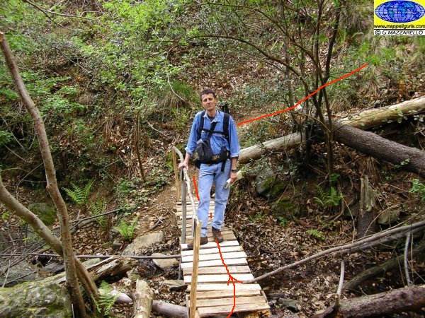
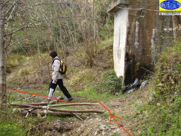
Il ponticello in legno poco prima della cascina Canova
The wooden bridge just before the house Canova
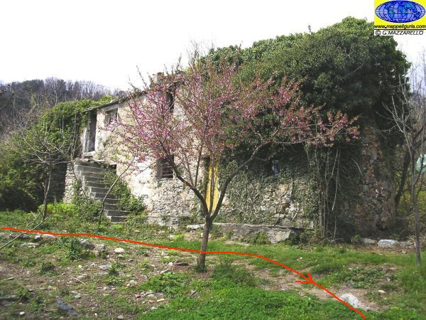
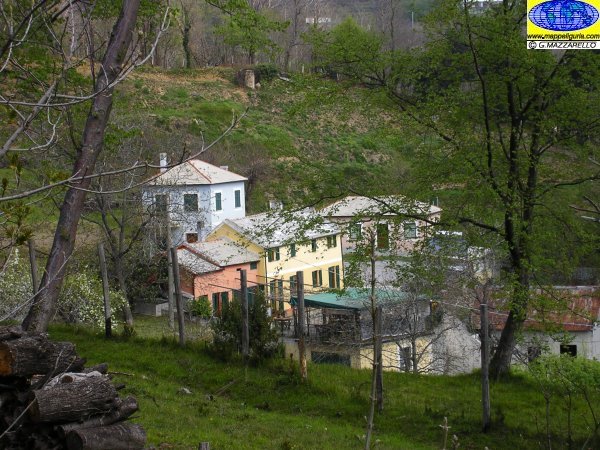
Cascina Canova
House Canova
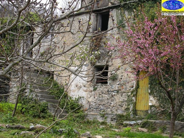
Cascina Canova
House Canova
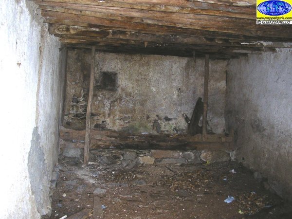
Cascina Canova
House Canova

Cascina Canova
House Canova

Panorama verso Genova
Panorama of Genova
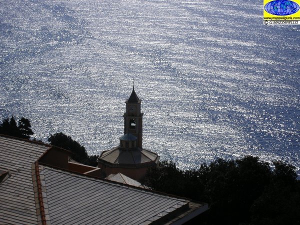
Panorama della chiesa di Crevari
Panorama of the church of Crevari
NOTE /NOTICE
Pur avendo prestato la massima attenzione nella stesura della descrizione del percorso, a causa della mutevolezza del territorio, della variabilita' delle condizioni meteo e di eventuali errori od imprecisioni o giudizi soggettivi indicati nel presente testo, l'autore declina ogni responsabilita' per eventuali incidenti che potrebbero verificarsi. Chi desidera effettuare questo percorso lo fa a proprio rischio e pericolo.
In the description of the route I have done the greatest care, but because of the changing nature of the area, the variability of weather conditions and any errors or inaccuracies or subjective judgments referred to in this text, the author disclaims all responsibility for any accidents that may occur. Those wishing to go this route you do so at your own risk.
Chiunque desiderasse avere maggiori informazioni su questo itinerario, mi
puo' contattare.
Do you want more information about this route?
Please write me
