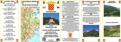
Itinerari TREKKING - PIEMONTE
TREKKING routes - PIEMONTE
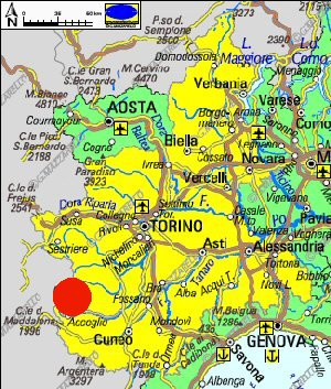
Piemonte042 - Valle Varaita: Lungotorrente Sampeyre-Casteldelfino (cascata La Piso)
DATA/DATE
Luglio 2014
July 2014
NOTE GENERALI / GENERAL NOTES
Lunga ma facile passeggiata sul sentiero che segue il Torrente Varaita fino alla cascata La Piso. E’ possibile percorrere questo itinerario anche solo parzialmente, partendo dai vari borghi che si incontrano sul tracciato.
Long but easy walk on the trail that follows the creek Varaita up to waterfall La Piso. It is possible to follow this route, only partially too, starting from various villages encountered on the track.
DATI SINTETICI DEL PERCORSO / ROUTE DATA
Distanza / Distance: 25 km
Dislivello / Difference: +/-400 m
Tempo / Time: 5:00-6:00 h
LOCALITA' DI PARTENZA / STARTING PLACE
Il percorso parte da Dughetti, frazione di Sampeyre (CN).
The route starts from Dughetti, fraction of Sampeyre (CN).
COME ARRIVARE / HOW TO REACH STARTING PLACE
![]() Dall'uscita del casello di Cuneo dell'Autostrada A33 si prende per Busca e poi
per Costigliole Saluzzo, dove si devia a sinistra per risalire tutta la Valle Varaita
fino a raggiungere Sampeyre dove, presso la diga del piccolo lago artificiale,
prendiamo a sinistra per Dughetti che raggiungiamo per lasciare l’auto.
Dall'uscita del casello di Cuneo dell'Autostrada A33 si prende per Busca e poi
per Costigliole Saluzzo, dove si devia a sinistra per risalire tutta la Valle Varaita
fino a raggiungere Sampeyre dove, presso la diga del piccolo lago artificiale,
prendiamo a sinistra per Dughetti che raggiungiamo per lasciare l’auto.
From the exit of Cuneo of the motorway A33, we take tor Busca and Costigliole Saluzzo, where we turn left to climb the Varaita Valley up to Sampeyre. At the dam near the small artificial lake, we take on left to reach Dughetti where we leave the car.
PERIODO / WHEN TO GO
Da inizio estate ad autunno inoltrato. Durante l’inverno e’ possibile percorrere questo itinerario con le ciaspole.
From early summer to late autumn. During the winter you can follow this route with snowshoes.
DIFFICOLTA' / DIFFICULTIES
Secondo la scala CAI: T (Turistica)
Il percorso si svolge su strade asfaltate e strade sterrate sempre
ben evidenti e segnalate, ma se si vuole percorrerlo tutto e’ necessario essere abituati a camminare a lungo.
![]()
According to the scale CAI: T (Tourist)
The route runs on paved roads and dirt roads always clearly visible and marked, but if you want the whole route, you must be accustomed to walking long.
SCHEDA PERCORSO / ROAD-BOOK
LIBRETTO DI 12 PAGINE CON TUTTI I DATI PER EFFETTUARE L'ITINERARIO
BOOKLET OF 12 PAGES WITH INSIDE ALL INFOMATIONS TO MAKE THE ROUTE
QUALCHE FOTO / SOME PICTURES
Presso Dughetti
At Dughetti
Il ponte che attraversa la condotta forzata
The bridge over the penstock
Il ponte in legno sul Rio Gros, presso Fiandrini
The wooden bridge over the Rio Gros, at Fiandrini
La grossa edicola votiva di Fiandrini
The big shrine of Fiandrini
Presso Garneri
At Garneri
Lungo il percorso verso Villar
Along the path towards Villar
Presso il camping
At camping
I campi da bocce di Villar
The petanque fields of Villar
Villar
Villar
Poco dopo Torrette
Just after Torrette
Verso il Ponte di Bac
Towards the Ponte di Bac
Verso la cascata La Piso
Towards La Piso waterfall
La cascata La Piso
La Piso waterfall
NOTE /NOTICE
Pur avendo prestato la massima attenzione nella stesura della descrizione del percorso, a causa della mutevolezza del territorio, della variabilita' delle condizioni meteo e di eventuali errori od imprecisioni o giudizi soggettivi indicati nel presente testo, l'autore declina ogni responsabilita' per eventuali incidenti che potrebbero verificarsi. Chi desidera effettuare questo percorso lo fa a proprio rischio e pericolo.
In the description of the route I have done the greatest care, but because of the changing nature of the area, the variability of weather conditions and any errors or inaccuracies or subjective judgments referred to in this text, the author disclaims all responsibility for any accidents that may occur. Those wishing to go this route you do so at your own risk.
Chiunque desiderasse avere maggiori informazioni su questo itinerario, mi
puo' contattare.
Do you want more information about this route?
Please write me



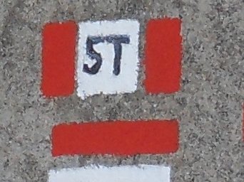




 Dalla Liguria al Piemonte su di un antico percorso tra storia natura e cultura
