
![]()
Itinerari TREKKING - PIEMONTE
TREKKING routes - PIEMONTE
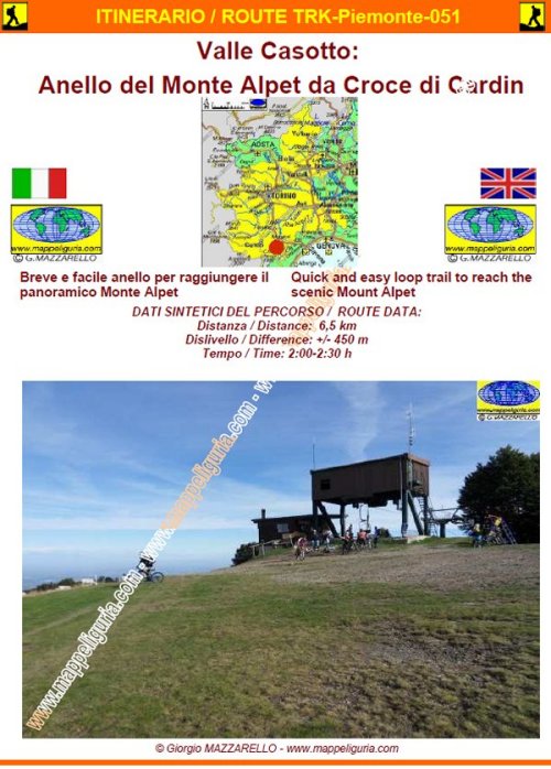
TRK-Piemonte-051 Valle Casotto: Anello del Monte Alpet da Croce di Cardin
DATA/DATE
Settembre 2014
September 2014
NOTE GENERALI / GENERAL NOTES
Breve e facile anello per raggiungere il panoramico Monte Alpet
Quick and easy loop trail to reach the scenic Mount Alpet
DATI SINTETICI DEL PERCORSO / ROUTE DATA
Distanza / Distance: 6,5 km
Dislivello / Difference: +/-450 m
Tempo / Time: 2:00-2:30 h
LOCALITA' DI PARTENZA / STARTING PLACE
Si parte dalla sella Croce Cardin nel comune di Roburent (CN)
The route starts from the saddle Cross Cardin in the municipality of Roburent (CN)
COME ARRIVARE / HOW TO REACH STARTING PLACE
![]() Dall�uscita di Niella Tanaro dell�autostrada A6, prendiamo a sinistra per San Michele Mondov�
e poi per Pamparato, dove deviamo a destra per san Giacomo di Roburent. Oltrepassiamo il borgo
di Serra e poco dopo presso una rotatoria prendiamo a sinistra per Cardini. Superiamo
il borgo di Cardini e saliamo ancora fino al termine della strada asfaltata presso
la sella Croce Cardin, dove lasciamo l�auto presso l�ampio piazzale.
Dall�uscita di Niella Tanaro dell�autostrada A6, prendiamo a sinistra per San Michele Mondov�
e poi per Pamparato, dove deviamo a destra per san Giacomo di Roburent. Oltrepassiamo il borgo
di Serra e poco dopo presso una rotatoria prendiamo a sinistra per Cardini. Superiamo
il borgo di Cardini e saliamo ancora fino al termine della strada asfaltata presso
la sella Croce Cardin, dove lasciamo l�auto presso l�ampio piazzale.
From the exit of Niella Tanaro of the A6 motorway, we take the left for San Michele Mondovi and then for Pamparato, where we turn off to the right for San Giacomo di Roburent. We pass the village of Serra and shortly after at a roundabout we turn left for Cardini. We pass the village of Cardini and go up again until the end of the paved road at the saddle Cross Cardin, where we leave the car at the large square.
PERIODO / WHEN TO GO
Da inizio estate ad autunno inoltrato.
In inverno e' un percorso da fare con le ciaspole.
From early summer to late autumn.
In winter it is a path to do with snowshoes.
DIFFICOLTA' / DIFFICULTIES
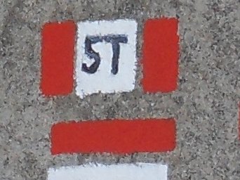
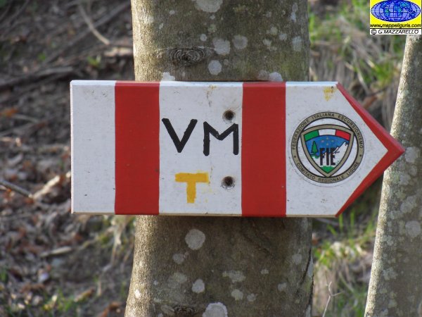
Secondo la scala CAI: T (Turistica)
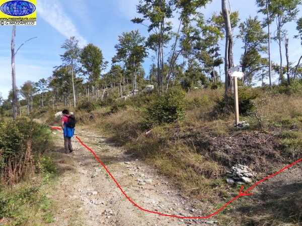
Il percorso si svolge su strade sterrate e su sentieri segnalati.
![]()
According to CAI classification: T (for Tourists).
The whole route runs on paved roads, dirt roads and easy paths, always well marked.
SCHEDA PERCORSO / ROAD-BOOK
LIBRETTO DI 8 PAGINE CON TUTTI I DATI PER EFFETTUARE L'ITINERARIO
BOOKLET OF 8 PAGES WITH INSIDE ALL INFOMATIONS TO MAKE THE ROUTE
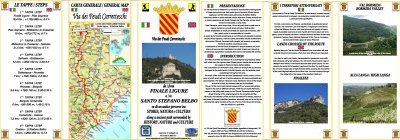
CARTE DI DETTAGLIO / DETAILED MAPS
Tutto il percorso descritto e' contenuto nelle seguenti tavole della collana
mini MAPPE OUTDOOR ACTIVITIES
This route is showed on following
mini MAPPE OUTDOOR ACTIVITIES type maps
Sei interessato alle CARTE DI DETTAGLIO di questo percorso?
CONTATTAMI
Are you interested about DETAILED MAPS of this route?
WRITE ME
QUALCHE FOTO / SOME PICTURES
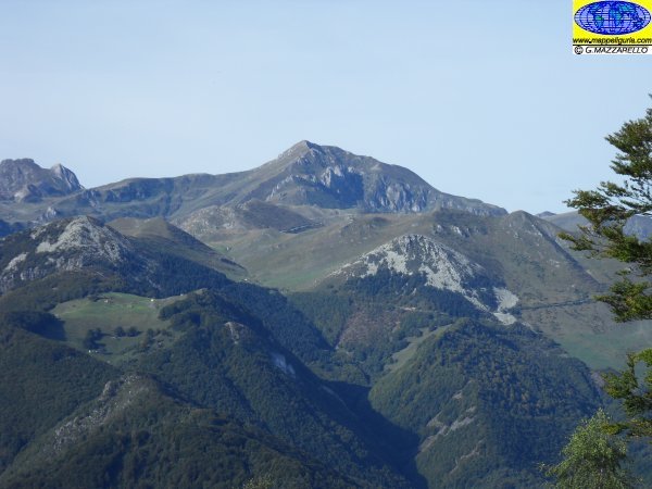
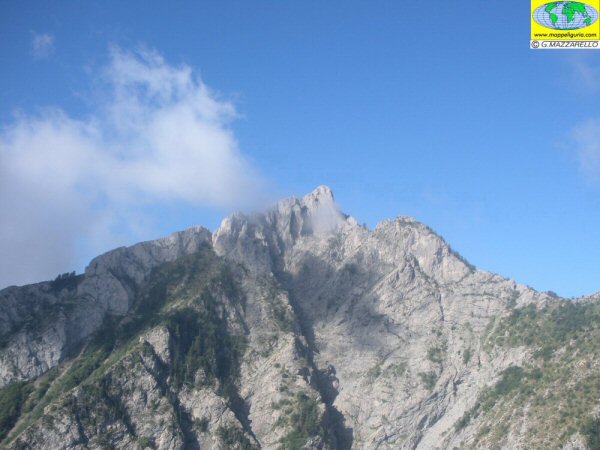
Panorama verso il Monte Mondole'
Panorama towards Mount Mondole'
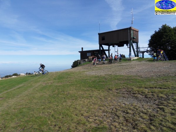
Presso la cima del Monte Alpet
At the summit of Mount Alpet
Presso la cima del Monte Alpet
At the summit of Mount Alpet
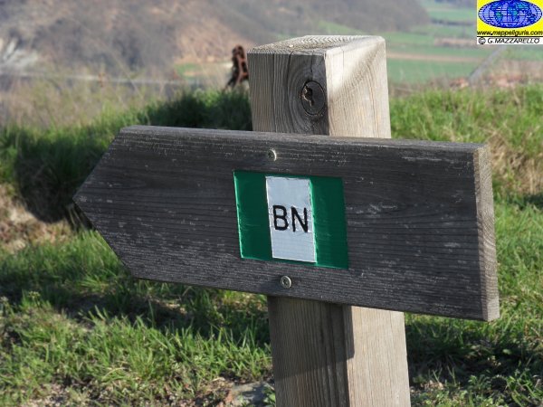
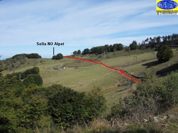
Il bivio presso la sella tra il Monte Alpet e la Roccia Pamparina
The junction at the saddle between Mount Alpet and Roccia Pamparina
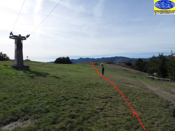
Gli ampi pascoli del versante sud-ovest del Monte Alpet
The vast pastures of the south-west slope of Mount Alpet
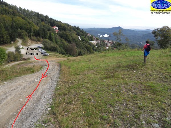
Presso la Croce Cardin
At the Cross Cardin
NOTE /NOTICE
Pur avendo prestato la massima attenzione nella stesura della descrizione del percorso, a causa della mutevolezza del territorio, della variabilita' delle condizioni meteo e di eventuali errori od imprecisioni o giudizi soggettivi indicati nel presente testo, l'autore declina ogni responsabilita' per eventuali incidenti che potrebbero verificarsi. Chi desidera effettuare questo percorso lo fa a proprio rischio e pericolo.
In the description of the route I have done the greatest care, but because of the changing nature of the area, the variability of weather conditions and any errors or inaccuracies or subjective judgments referred to in this text, the author disclaims all responsibility for any accidents that may occur. Those wishing to go this route you do so at your own risk.
Chiunque desiderasse avere maggiori informazioni su questo itinerario, mi
puo' contattare.
Do you want more information about this route?
Please write me
