
![]()
Itinerari TREKKING - PIEMONTE
TREKKING routes - PIEMONTE
TRK-Piemonte-063
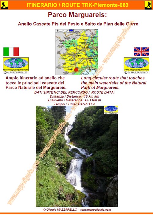
Parco Marguareis:
Anello delle Cascate del Pis del Pesio e del Salto da Pian delle Gorre
Marguareis Park:
Loop of Pis del Pesio and Salto waterfalls starting from Pian delle Gorre

DATA/DATE
Luglio 2015
July 2015
NOTE GENERALI / GENERAL NOTES
Ampio itinerario ad anello che tocca le principali cascate del PARCO NATURALE DEL MARGUAREIS.
Large circular route that touches the main waterfalls of the NATURAL PARK OF MARGUAREIS.
DATI SINTETICI DEL PERCORSO / ROUTE DATA
Distanza / Distance: 16 km
Dislivello / Difference: +/-1100 m
Tempo / Time: 4:45-5:15 h
LOCALITA' DI PARTENZA / STARTING PLACE
Il percorso inizia dal Pian delle Gorre, nel comune di Chiusa Pesio (CN)
The route starts from Pian delle Gorre, in the municipality of Chiusa Pesio (CN)
COME ARRIVARE / HOW TO REACH STARTING PLACE
![]() Dall’uscita del casello di Mondově dell’autostrada A6, prendiamo per Mondově e
poi per Pianfei dove deviamo per Chiusa Pesio che oltrepassiamo per proseguire
a sinistra in direzione della Certosa di Pesio e del Pian delle Gorre.
Oltrepassiamo la Certosa e raggiungiamo il Pian delle Gorre, dove lasciamo
l’auto presso l’ampio piazzale presso il rifugio.
Dall’uscita del casello di Mondově dell’autostrada A6, prendiamo per Mondově e
poi per Pianfei dove deviamo per Chiusa Pesio che oltrepassiamo per proseguire
a sinistra in direzione della Certosa di Pesio e del Pian delle Gorre.
Oltrepassiamo la Certosa e raggiungiamo il Pian delle Gorre, dove lasciamo
l’auto presso l’ampio piazzale presso il rifugio.
From the exit of Mondovi, the A6 motorway, and then take to Mondovi for Pianfei, where we turn off to Chiusa Pesio that we pass to go left in the direction of the Certosa di Pesio and the Pian delle Gorre. We pass the Certosa and reach the Pian delle Gorre, where we leave the car at the large square at the shelter.
PERIODO / WHEN TO GO
Da inizio estate ad autunno inoltrato.
From early summer to late autumn.
DIFFICOLTA' / DIFFICULTIES
Secondo la scala CAI: E (Escursionistica)
Il percorso si svolge su strade sterrate e su sentieri segnalati.
![]()
According to CAI classification: E (for Normal Hiker).
The whole route runs on paved roads, dirt roads and easy paths, always marked.
SCHEDA PERCORSO / ROAD-BOOK
LIBRETTO DI 10 PAGINE CON TUTTI I DATI PER EFFETTUARE L'ITINERARIO
BOOKLET OF 10 PAGES WITH INSIDE ALL INFOMATIONS TO MAKE THE ROUTE
QUALCHE FOTO / SOME PICTURES
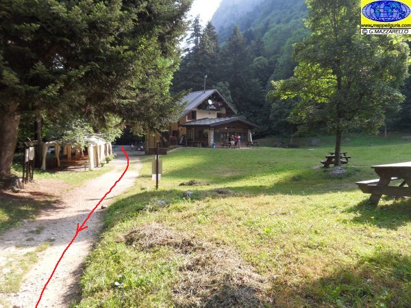
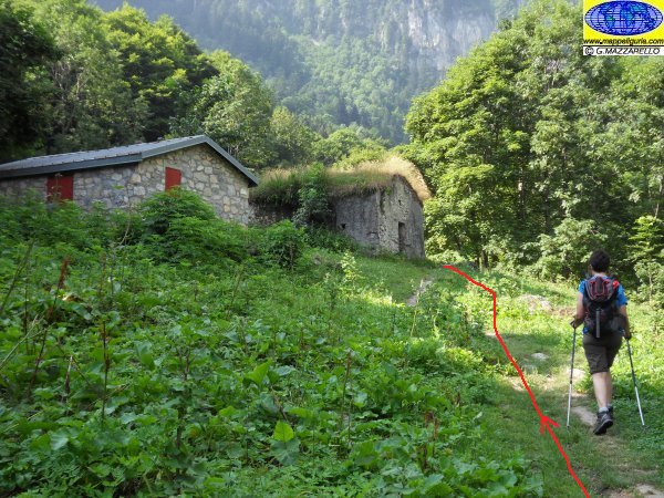
Presso il Pian delle Gorre
At Pian delle Gorre
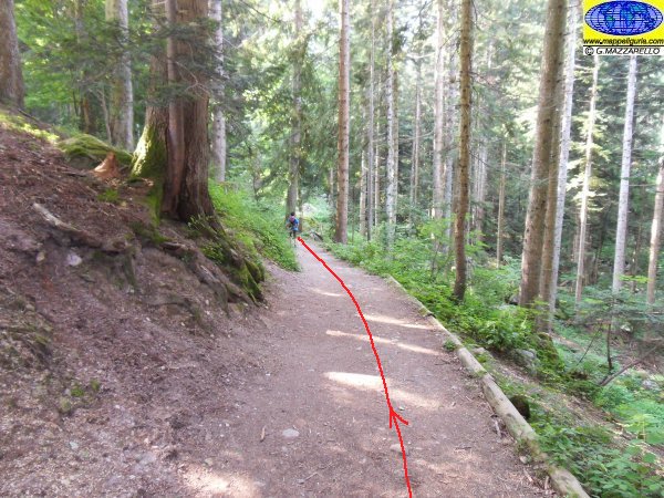
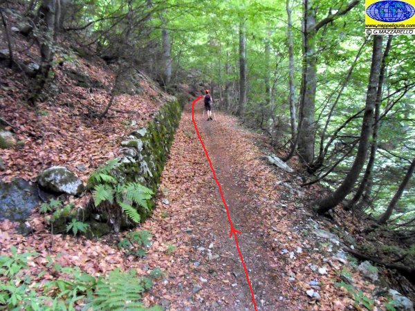
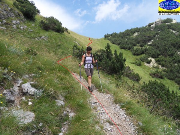
Lungo la prima parte del percorso
Along the first section of roure
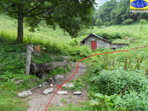
Presso il Gias Fontana
At Gias Fontana
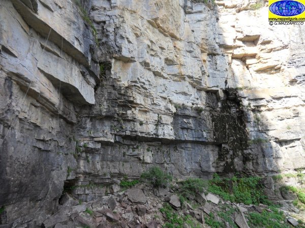
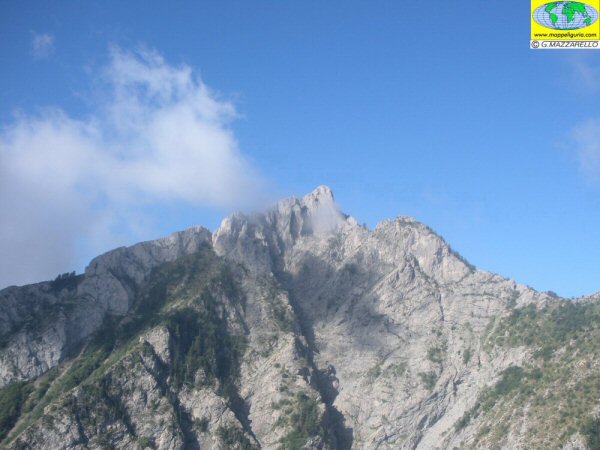
La parete rocciosa dove sgorga la cascata del pis del Pesio, che in estate e' spesso secca
The rock wall where flows the waterfall of pis of Pesio, which in summer is often dry

Foto di rito
Usual photos
Presso il piccolo edificio del Gias degli Arpi
At the small building of Gias degli Arpi
Lungo la strada militare, poco dopo il Gias degli Arpi
Along the military road, shortly after Gias of Arpi
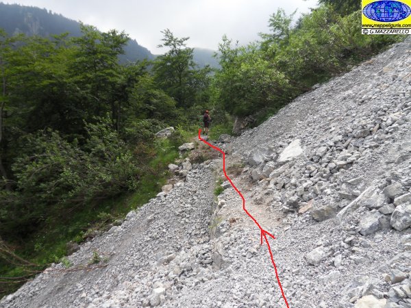
Presso il breve tratto di pietre e detriti da superare dopo il Gias degli Arpi
At the short stretch of rocks and debris to pass after Gias of Arpi
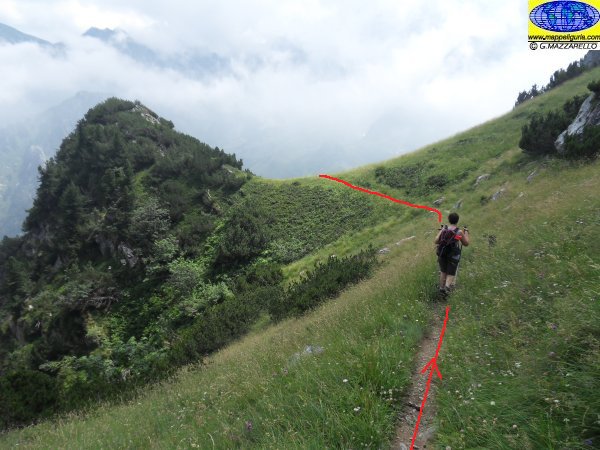
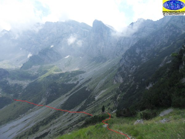
Panorama sul Vallone degli Arpi
Valley of Arpi

Il Colle del Prel
At Colle del Prel
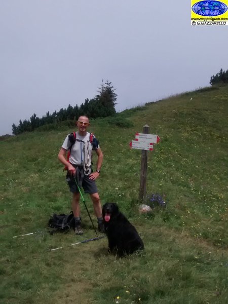
Presso il Colle del Prel Superiore
At Colle del Prel Superiore
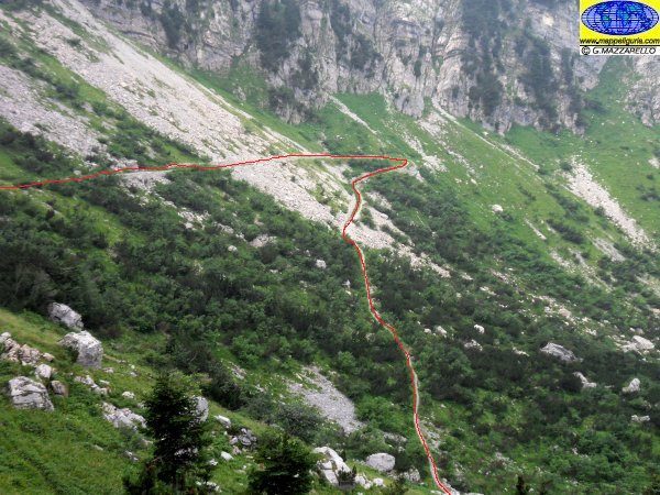
Lungo il sentiero che scende verso il Vallone del Marguareis
Along the path down to the Valley of Marguareis
Lungo il sentiero che scende verso il Vallone del Marguareis
Along the path down to the Valley of Marguareis
Panorama sul Vallone del Marguareis
Panorama of Valley of Marguareis
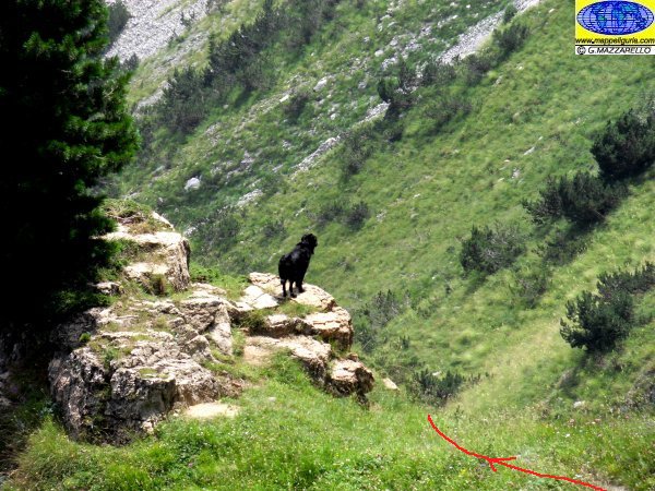
Il "Diavolo Nero" che scruta in cerca di prede
The "Black Devil" looking for prey
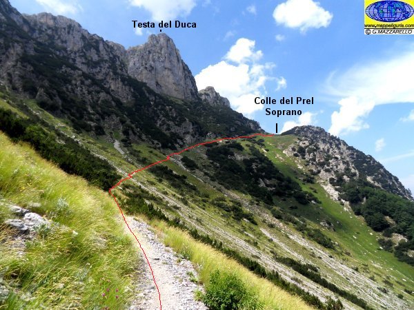
Panorama sulla Testa del Duca
Panorama of Testa del Duca
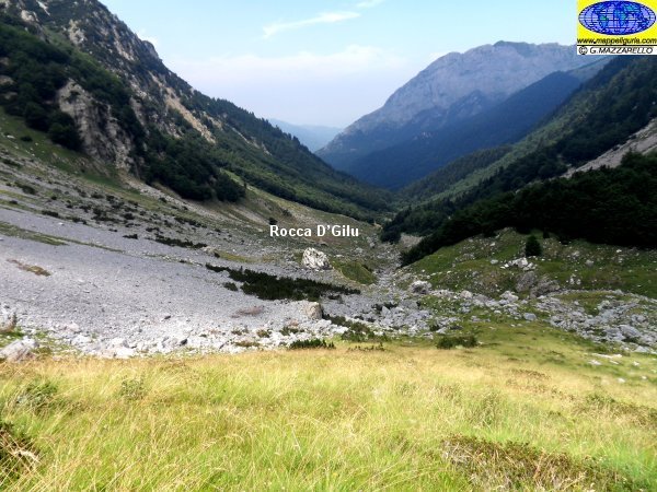
Panorama sul Vallone del Marguareis e sul masso erratico "Rocca D’Gilu"
Panorama of Valley of Marguareis and over the boulder "Rocca D’Gilu"
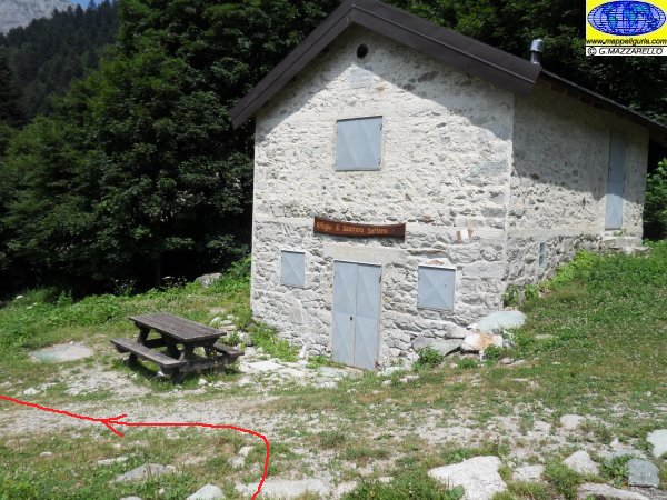
Presso il Rifugio Sottano di Sestrera
At the shelter Sottano of Sestrera
La prima Cascata del Salto
First Salto Waterfall
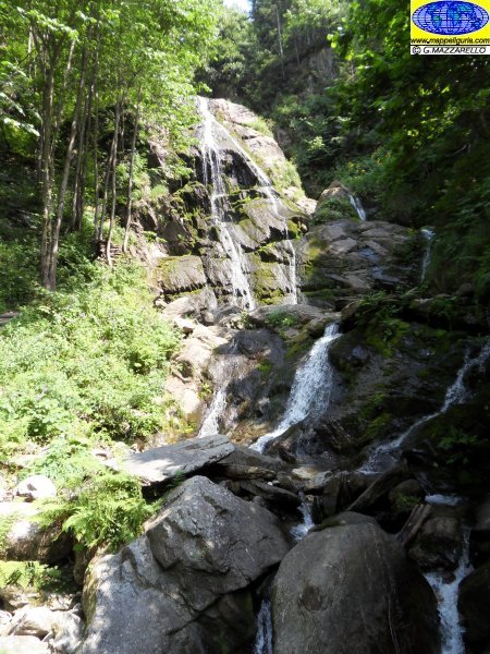
La seconda Cascata del Salto
Second Salto Waterfall
NOTE /NOTICE
Pur avendo prestato la massima attenzione nella stesura della descrizione del percorso, a causa della mutevolezza del territorio, della variabilita' delle condizioni meteo e di eventuali errori od imprecisioni o giudizi soggettivi indicati nel presente testo, l'autore declina ogni responsabilita' per eventuali incidenti che potrebbero verificarsi. Chi desidera effettuare questo percorso lo fa a proprio rischio e pericolo.
In the description of the route I have done the greatest care, but because of the changing nature of the area, the variability of weather conditions and any errors or inaccuracies or subjective judgments referred to in this text, the author disclaims all responsibility for any accidents that may occur. Those wishing to go this route you do so at your own risk.
Chiunque desiderasse avere maggiori informazioni su questo itinerario, mi
puo' contattare.
Do you want more information about this route?
Please write me
