
![]()
Itinerari TREKKING - Provincia di Genova
TREKKING routes - Genova district
TRK-GE-114
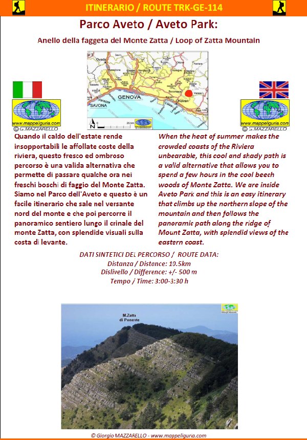
Parco dell'Aveto:
Anello della faggeta del Monte Zatta
Aveto Park:
Loop of Zatta Mountain beechwood
DATA/DATE
Agosto 2013
August 2013
NOTE GENERALI / GENERAL NOTES
Quando il caldo dell'estate rende insopportabili le affollate coste della riviera, questo fresco ed ombroso percorso è una valida alternativa che permette di passare qualche ora nei freschi boschi di faggio del Monte Zatta. Siamo nel PARCO DELL'AVETO e questo è un facile itinerario che sale nel versante nord del monte e che poi percorre il panoramico sentiero lungo il crinale del monte Zatta, con splendide visuali sulla costa di levante.
When the heat of summer makes the crowded coasts of the Riviera unbearable, this cool and shady path is a valid alternative that allows you to spend a few hours in the cool beech woods of Monte Zatta. We are inside AVETO PARK, and this is an easy itinerary that climbs up the northern slope of the mountain and then follows the panoramic path along the ridge of Mount Zatta, with splendid views of the eastern coast.
DATI SINTETICI DEL PERCORSO / ROUTE DATA
Distanza / Distance: 10.5 km
Dislivello / Difference: +/-500 m
Tempo / Time: 3:00-3:30 h
LOCALITA' DI PARTENZA / STARTING PLACE
Il percorso inizia dal Passo del Bocco, comune di Mezzanego (GE).
The route starts from Passo del Bocco, municipality of Mezzanego (GE)
COME ARRIVARE / HOW TO REACH STARTING PLACE
![]() Dall'uscita del casello di Lavagna dell'autostrada A10 raggiungiamo Carasco
e poi prendiamo per Borzonasca. Presso Borgonovo di Mezzanego deviamo
a destra per il Passo del Bocco, che raggiungiamo dopo circa 15 km.
Al Passo del Bocco, di fronte al Rifugio Devoto, prendiamo la strada a
destra (indicazioni per Varese Ligure) e dopo meno di 300 m,
presso un edificio a abbandonato, lasciamo l'auto a destra
dove inizia una strada sterrata che sale (spiazzo e bacheca in legno).
Dall'uscita del casello di Lavagna dell'autostrada A10 raggiungiamo Carasco
e poi prendiamo per Borzonasca. Presso Borgonovo di Mezzanego deviamo
a destra per il Passo del Bocco, che raggiungiamo dopo circa 15 km.
Al Passo del Bocco, di fronte al Rifugio Devoto, prendiamo la strada a
destra (indicazioni per Varese Ligure) e dopo meno di 300 m,
presso un edificio a abbandonato, lasciamo l'auto a destra
dove inizia una strada sterrata che sale (spiazzo e bacheca in legno).
From the exit of the Lavagna tollbooth, of the A10 motorway, we reach Carasco and then we take to Borzonasca. At Borgonovo di Mezzanego we turn right to the Passo del Bocco, which we reach after about 15 km. At Passo del Bocco, opposite the Devoto Refuge, take the road to the right (signs for Varese Ligure) and after less than 300 m, at an abandoned building, we leave the car to the right where a dirt road begins that goes up (small area and wooden notice board).
PERIODO / WHEN TO GO
Tutto l'anno. In inverno potrebbe esserci neve e ghiaccio.
All the year. In winter there could be snow and ice.
DIFFICOLTA' / DIFFICULTIES
Secondo la scala CAI: T-E (Turistica-Escursionistica).
Tutto il percorso si svolge su strade sterrate, e su sentieri ben segnalati.
According to the CAI scale: T-E (for Tourists - for Normal Hikers);
The entire route takes place on dirt roads, and on well-marked trails.
SCHEDA PERCORSO / ROAD-BOOK
LIBRETTO DI 10 PAGINE CON TUTTI I DATI PER EFFETTUARE L'ITINERARIO
BOOKLET OF 10 PAGES WITH INSIDE ALL INFOMATIONS TO MAKE THE ROUTE
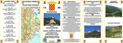
CARTE DI DETTAGLIO / DETAILED MAPS
Tutto il percorso descritto e' contenuto nelle seguenti tavole della collana
mini MAPPE OUTDOOR ACTIVITIES
This route is showed on following
mini MAPPE OUTDOOR ACTIVITIES type maps
Per raggiungere la localita' di partenza e' utile utilizzare la seguente tavola della
collana mini MAPPE CAR
To reach starting places is useful following
mini MAPPE CAR type map
Sei interessato alle CARTE DI DETTAGLIO di questo percorso?
CONTATTAMI
Are you interested about DETAILED MAPS of this route?
WRITE ME
QUALCHE FOTO / SOME PICTURES
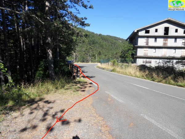
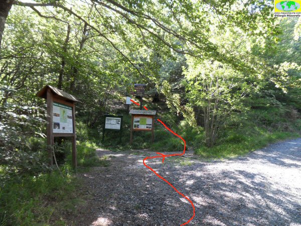
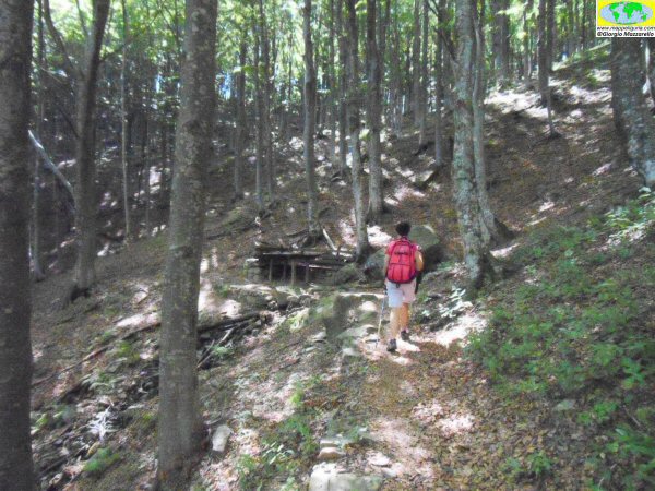
Il posto dove inizia il percorso
The place where the route begins
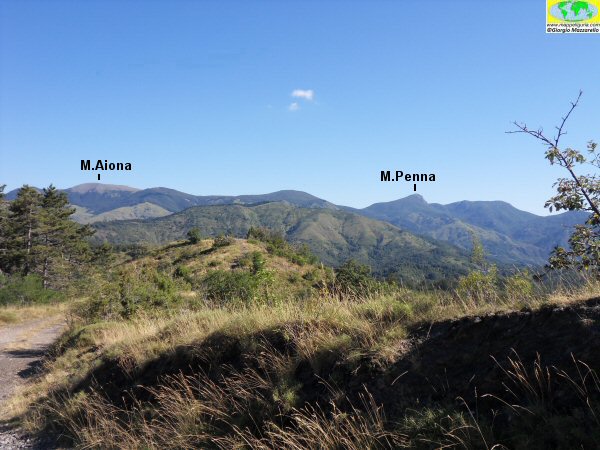
Salendo lungo la sterrata per l'Ex Colonia Devoto, alle spalle è possibile vedere questo panorama verso il crinale dei monti Penna e Aiona.
Going up along the dirt road to the Ex Colonia Devoto, you can see this panorama behind you towards the ridge of the Penna and Aiona mountains.
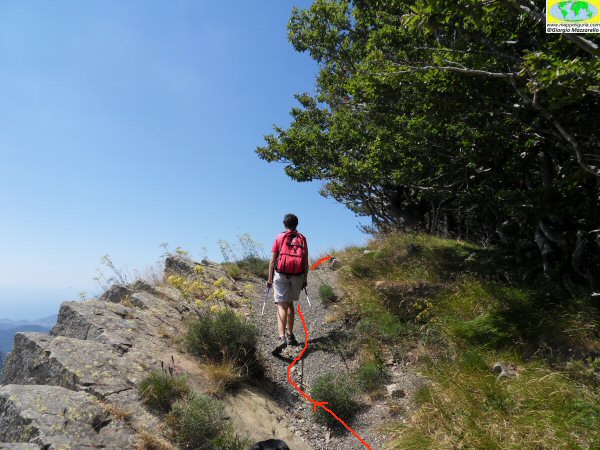
Presso il bivio dove lasciamo la strada sterrata per deviare a sinistra su sentiero
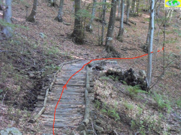
Salendo nel bosco, poco dopo avere costeggiato una recinzione si incontra questa passerella di legno
At the junction where we leave the dirt road to turn left onto the path
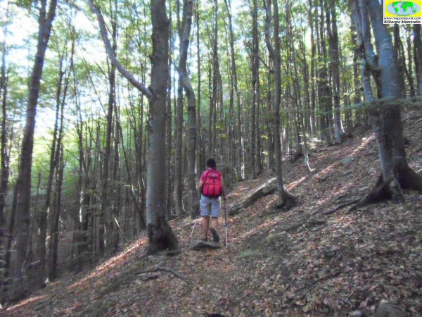
Lungo il sentiero verso la Fonte Prato Pinello
Along the path to the Fonte Prato Pinello
Presso la Fonte Prato Pinello
At the Fonte Prato Pinello
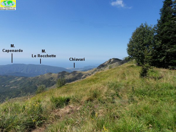
Panorama verso Chiavari dal crinale del Monte Zatta.
Panorama towards Chiavari from the ridge of Mount Zatta.
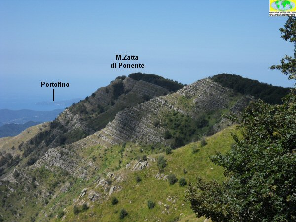
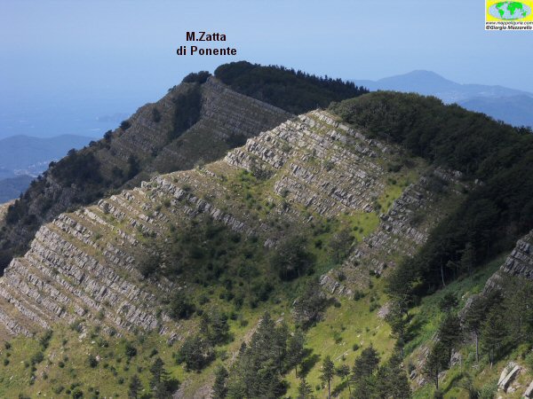
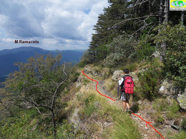
Il crinale del Monte Zatta verso ponente.
The ridge of Monte Zatta towards the west.
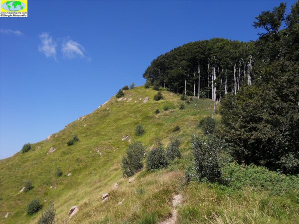
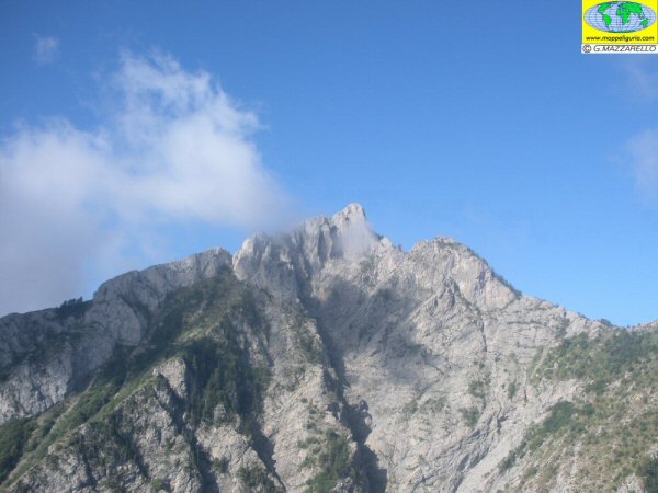
La vetta del Monte Zatta di Levante
The summit of Monte Zatta di Levante
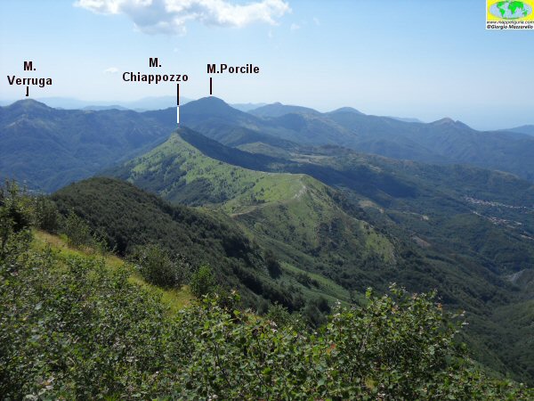
Panorama sopra il crinale che scende verso le Cinque Terre. Si distinguono bene i monti, Verruga, Porcile e Chiappozzo.
Panorama over the ridge that descends towards the Cinque Terre. The mountains, Verruga, Porcile and Chiappozzo are well distinguished.
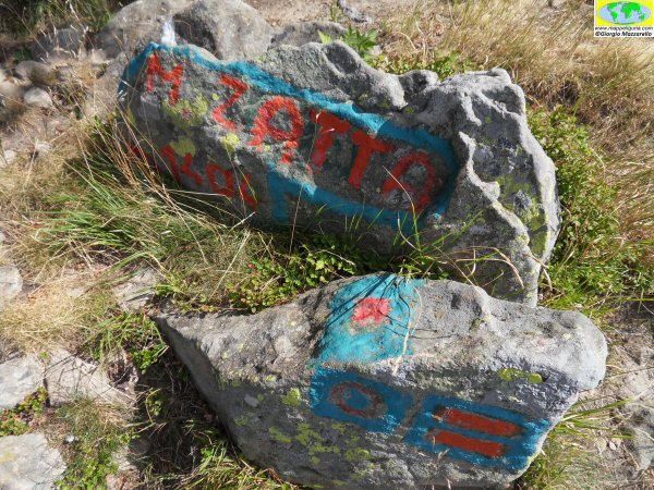
La vetta di Levante dello Zatta
La vetta del Monte Zatta di Levante
The summit of Monte Zatta di Levante
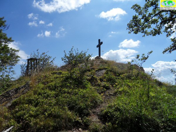
La vetta centrale dello Zatta dove è presente la croce in legno.
The central peak of the Zatta where the wooden cross is present.
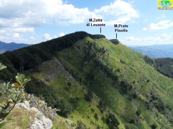
Panorama sul crinale verso levante.
Camminando verso la vetta di Ponente dello Zatta
Panorama on the ridge towards east.
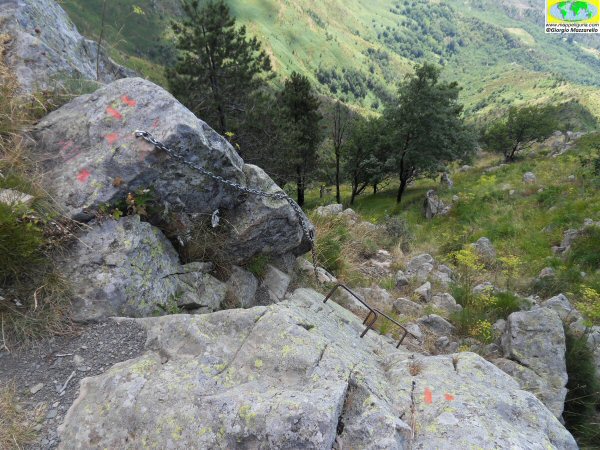
Il sentiero attrezzato che scende verso Reppia
The equipped path that descends towards Reppia
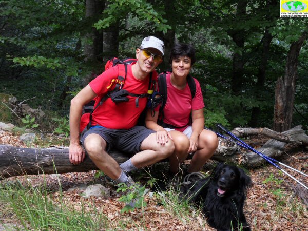
Foto di rito
Ritual photo
Scendendo poco dopo il Poggio Buenos Aires
Going down shortly after the Poggio Buenos Aires
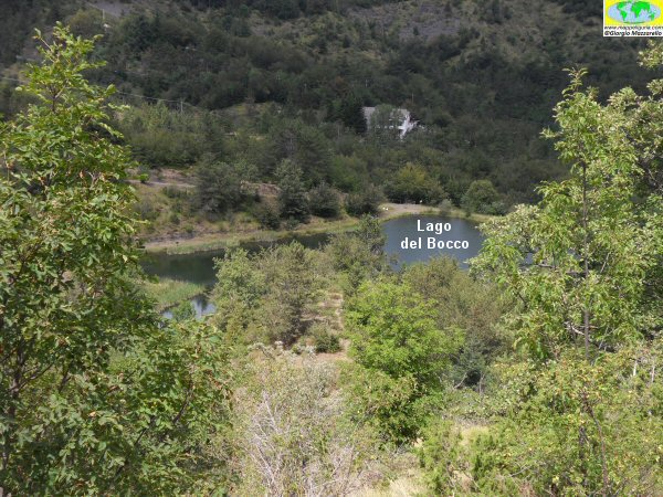
Il piccolo laghetto del Passo del Bocco
The small lake of Passo del Bocco
NOTE /NOTICE
Pur avendo prestato la massima attenzione nella stesura della descrizione del percorso, a causa della mutevolezza del territorio, della variabilita' delle condizioni meteo e di eventuali errori od imprecisioni o giudizi soggettivi indicati nel presente testo, l'autore declina ogni responsabilita' per eventuali incidenti che potrebbero verificarsi. Chi desidera effettuare questo percorso lo fa a proprio rischio e pericolo.
In the description of the route I have done the greatest care, but because of the changing nature of the area, the variability of weather conditions and any errors or inaccuracies or subjective judgments referred to in this text, the author disclaims all responsibility for any accidents that may occur. Those wishing to go this route you do so at your own risk.
Chiunque desiderasse avere maggiori informazioni su questo itinerario, mi
puo' contattare.
Do you want more information about this route?
Please write me
