
![]()
Itinerari TREKKING - Provincia di Savona
TREKKING routes - Savona district
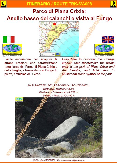
SV-008
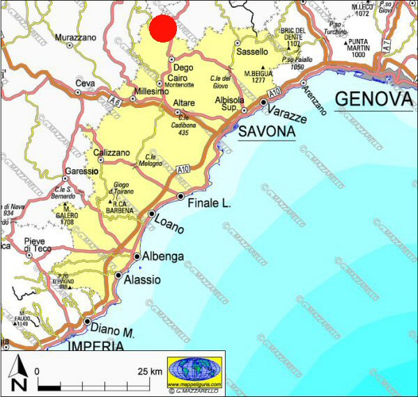
Parco di Piana Crixia: Anello basso dei calanchi e visita al Fungo
Piana Crixia Park: Loop low of the gullies and visit the stone Mushroom
DATA/DATE
Dicembre 2011
December 2011
NOTE GENERALI / GENERAL NOTES
Facile escursione per scoprire le strane erosioni che caratterizzano tutta l'area del PARCO DI PIANA CRIXIA e delle langhe, e breve visita al Fungo in pietra, emblema del Parco. .
Easy hike to discover the strange erosion that characterize the whole area of the PARCO DI PIANA CRIXIA and the Langhe, and brief visit to Mushroom stone symbol of the park.
DATI SINTETICI DEL PERCORSO / ROUTE DATA
Distanza / Distance: 8 km
Dislivello / Difference: +/-350 m
Tempo / Time: 2:00-2:30 h
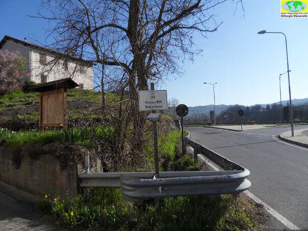
LOCALITA' DI PARTENZA / STARTING PLACE
Si parte dall�Area picnic (quota 265m) situata in localit� Ponte Vecchio nel comune di Piana Crixia. (SV).
The route starts from the picnic area ( 265m) located in Ponte Vecchio in the village of Piana Crixia. (SV).
COME ARRIVARE / HOW TO ARRIVE
![]() Dall�uscita del casello di Altare dell'autostrada A6 si prende a DX per Cairo Montenotte.
Si segue la statale 29 si supera Cairo M., Rocchetta Cairo e Dego
fino a raggiungere Piana Crixia dove si puo' lasciare l'auto nei pressi della
grossa area picnic nella frazione Ponte Vecchio.
Dall�uscita del casello di Altare dell'autostrada A6 si prende a DX per Cairo Montenotte.
Si segue la statale 29 si supera Cairo M., Rocchetta Cairo e Dego
fino a raggiungere Piana Crixia dove si puo' lasciare l'auto nei pressi della
grossa area picnic nella frazione Ponte Vecchio.
From Altare exit of the A6 motorway, take right to Cairo Montenotte. Following the road 29, you past Cairo Montenotte, Rocchetta Cairo and Dego and you reach Crixia where you can leave your car near the large picnic area at Ponte Vecchio.
PERIODO / WHEN TO GO
Da inizio primavera ad autunno inoltrato. In inverno la possibile presenza di neve e/o ghiaccio, rendono questo percorso fattibile con ciaspole.
From early spring to late autumn.
In winter, the possible presence of snow and / or ice, make this feasible route with snowshoes.
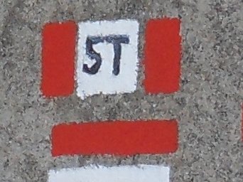
DIFFICOLTA' / DIFFICULTIES
Secondo la scala CAI: T-E (Turistica-Escursionistica).
Quasi tutto il percorso si svolge su sterrate e su sentieri evidenti e parzialmente segnalati.
According to CAI scale: T-E (Turistica-Escursionistica).
Almost the entire route takes place on dirt roads and trails clearly visible and partially signposted.
SCHEDA PERCORSO / ROAD-BOOK
LIBRETTO DI 12 PAGINE CON TUTTI I DATI PER EFFETTUARE L'ITINERARIO
BOOKLET OF 12 PAGES WITH INSIDE ALL INFOMATIONS TO MAKE THE ROUTE
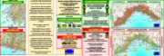
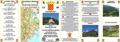
CARTE DI DETTAGLIO / DETAILED MAPS
Tutto il percorso descritto e' contenuto nelle seguenti tavole della collana
mini MAPPE OUTDOOR ACTIVITIES
This route is showed on following
mini MAPPE OUTDOOR ACTIVITIES type maps
Per raggiungere la localita' di partenza e' utile utilizzare la seguente tavola della
collana mini MAPPE CAR
To reach starting places is useful following
mini MAPPE CAR type map
Sei interessato alle CARTE DI DETTAGLIO di questo percorso?
CONTATTAMI
Are you interested about DETAILED MAPS of this route?
WRITE ME
QUALCHE FOTO / SOME PICTURES
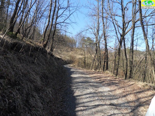
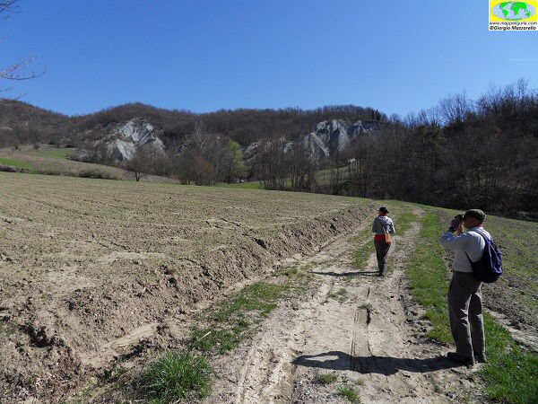
L'inizio del percorso / The beginning of the path
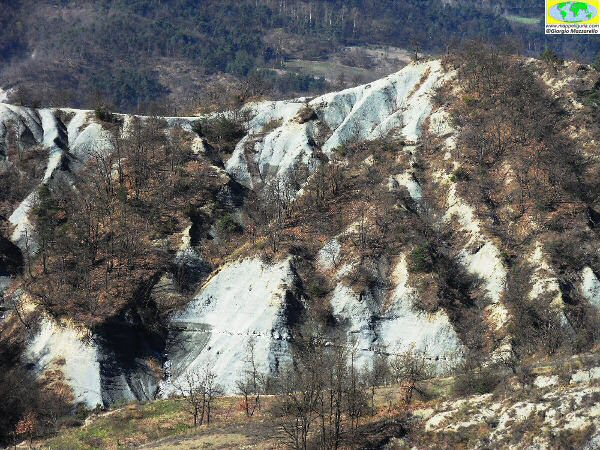
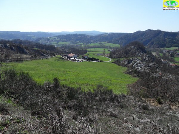
Panorama sulla prima parte dei calanchi / Panorama on the first part of the calanchi
Effimere onde di sabbia / Ephemeral sand waves
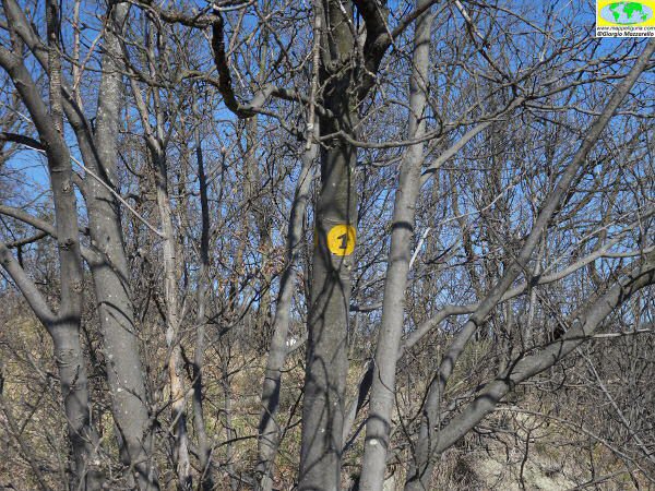
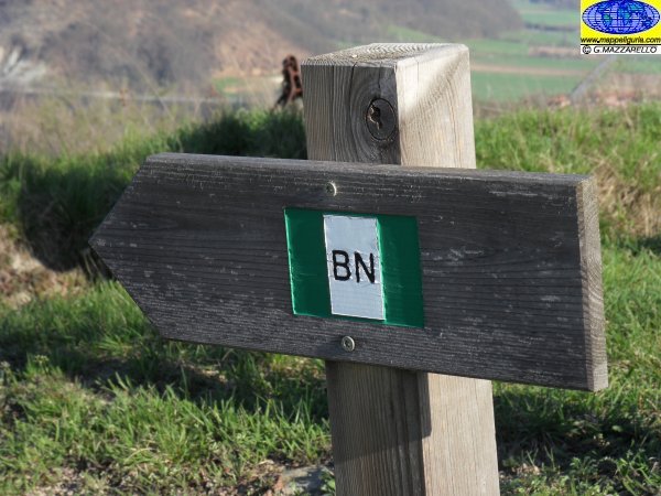
Uno dei segnavia che si incontrano / One of the signpost which meet
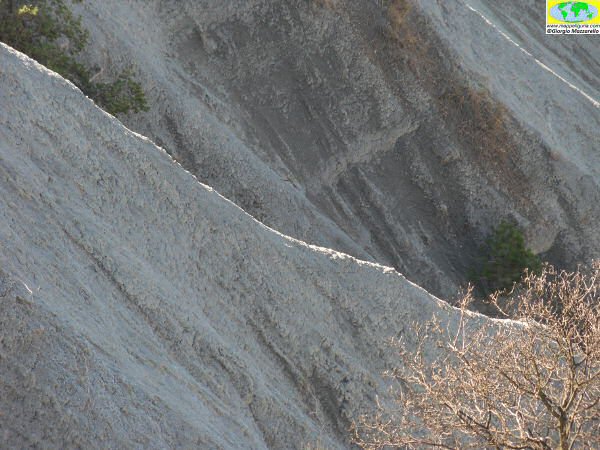
Affilate creste di sabbia / Sharp ridges of sand
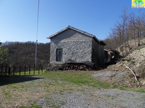
Presso casa Coda / At casa Coda

L'area dei calanchi in territorio piemontese / The area of the calanchi in the Piedmont area
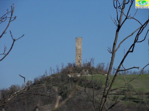
Torre di Merana / Merana Tower
Lungo il percorso che sale al crinale / Along the path that climbs to the ridge
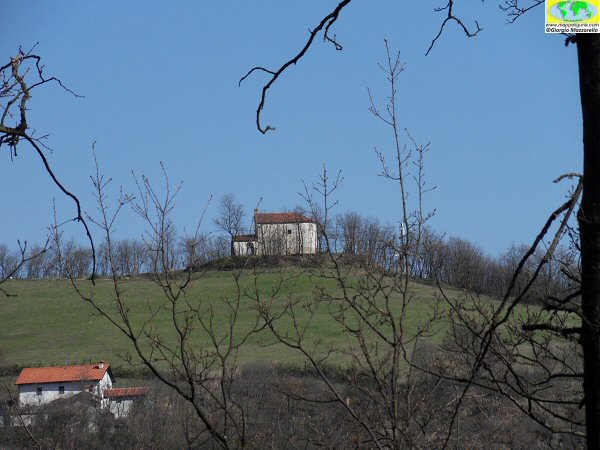
La chiesa di S.Fermo / S.Fermo church
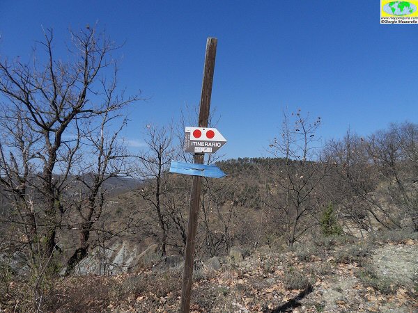
Segnavia / Signpost
Panorama su Ferrieto / Panorama of Ferrieto
Camminando tra campi / Walking through fields
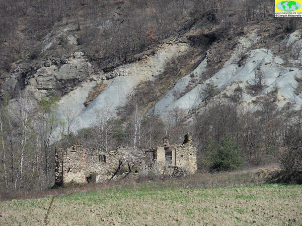
Il rudere che si incontra dopo Ferrieto / The ruin which meets after Ferrieto
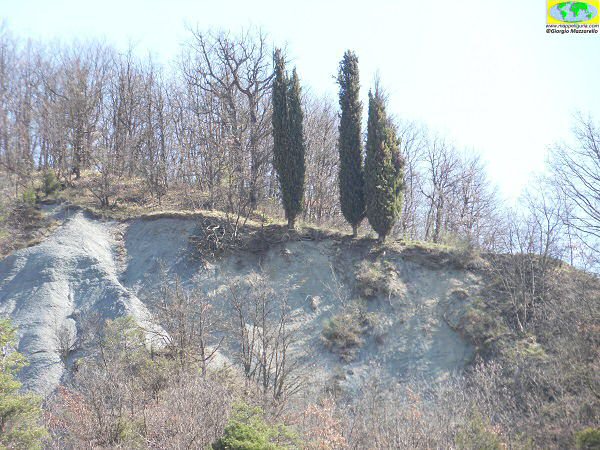
Calanchi e cipressi / Gullies and cypress
Case Grintorto / Grintorto house
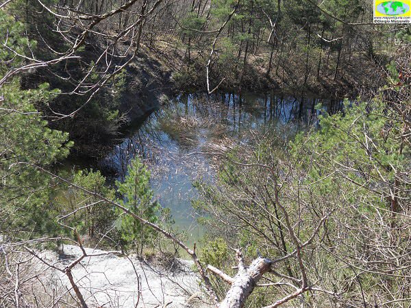
la piccola area umida che si incontra / small wetland that meets
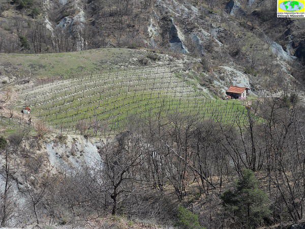
Vigneti e calanchi / Vineyards and gullies
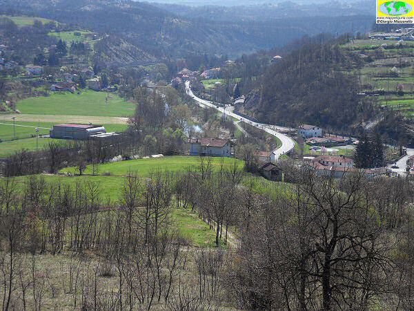
Panorama su Piana Crixia / Panorama of Piana Crixia
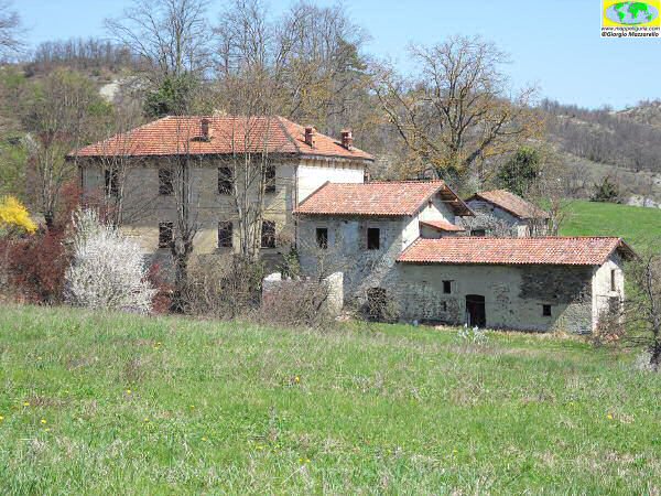
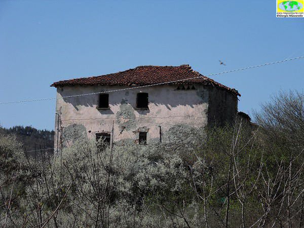
Il casale di Monte Bergone / The house of Monte Bergone

Pesco in fiore presso la partenza dell'itinerario / Peach tree in bloom at the start of the route
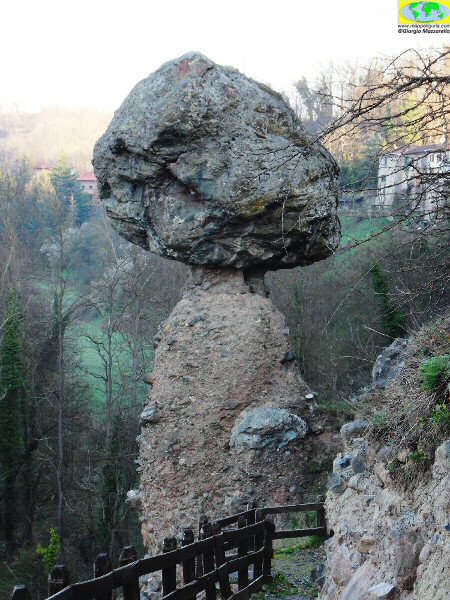
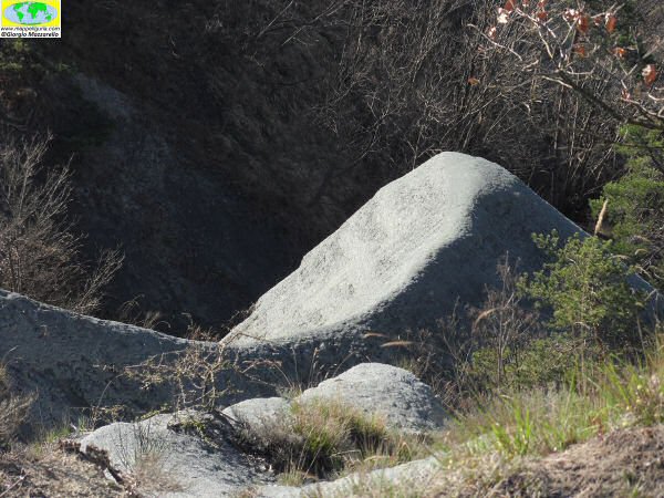
Il grosso Fungo in pietra presso la frazione Borgo / The big mushroom stone in the hamlet Borgo
NOTE /NOTICE
Pur avendo prestato la massima attenzione nella stesura della descrizione del percorso, a causa della mutevolezza del territorio, della variabilita' delle condizioni meteo e di eventuali errori od imprecisioni o giudizi soggettivi indicati nel presente testo, l'autore declina ogni responsabilita' per eventuali incidenti che potrebbero verificarsi. Chi desidera effettuare questo percorso lo fa a proprio rischio e pericolo.
In the description of the route I have done the greatest care, but because of the changing nature of the area, the variability of weather conditions and any errors or inaccuracies or subjective judgments referred to in this text, the author disclaims all responsibility for any accidents that may occur. Those wishing to go this route you do so at your own risk.
Chiunque desiderasse avere maggiori informazioni su questo itinerario, mi
puo' contattare.
Do you want more information about this route?
Please write me
