


![]()
TRAIL MAP - SciaccheTrail 2015 - Monterosso al Mare (SP)
![]() Nel 2015 nasce il "SciaccheTrail", gara di Trail-Running nel cuore del
PARCO NAZIONALE DELLE CINQUE TERRE.
Nel 2015 nasce il "SciaccheTrail", gara di Trail-Running nel cuore del
PARCO NAZIONALE DELLE CINQUE TERRE.
Questa gara ha tutte le carte per diventare una classica di livello internazionale.
I quasi 50 km di lunghezza, lungo i ripidi sentieri delle Cinque Terre, e gli oltre 3000 m di dislivello,
distribuiti in numerose salite e discese, che si susseguono costantemente lungo tutto il percorso fino al termine,
rendono questa gara molto impegnativa sia dal punto di vista fisico che tecnico.
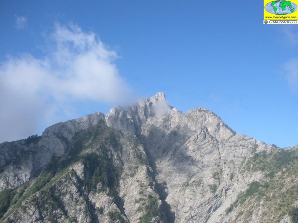
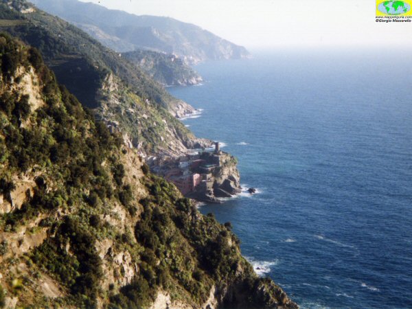
L'ambiente che si attraversa e' davvero unico. Si percorrono sentieri di montagna a picco sul mare, attraversando pittoreschi borghi marini,
ripide e ordinate vigne, antichi Santuari e scogliere verticali.
![]() In 2015 comes the "SciaccheTrail", Trail-Running race in the heart of the
PARCO NAZIONALE DELLE CINQUE TERRE.
In 2015 comes the "SciaccheTrail", Trail-Running race in the heart of the
PARCO NAZIONALE DELLE CINQUE TERRE.
The nearly 50 km in length, along the steep paths of the Cinque Terre, and the more than 3000 m in altitude,
distributed in numerous ascents and descents, which occur constantly all the way until the end,
make this race very demanding from physically and technically point of view.
The environment that you cross is truly unique. You run on mountain trails overlooking the sea,
crossing picturesque seaside villages, steep and tidy vineyards, ancient sanctuaries and vertical cliffs.
ATTENZIONE / WARNING
QUESTO NON E' IL SITO UFFICIALE DEL SCIACCHETRAIL
THIS IS NOT THE OFFICIAL WEB-SITE OF THE SCIACCHETRAIL RACE
ma sono solo alcune pagine che ho voluto dedicare a questa splendida gara.
but it is only a web-page which I have devoted to this race.
Per maggiori informazioni e dati ufficiali consulta il sito ufficiale della gara:
For more information and official data on the event see
SITO UFFICIALE DELLA MANIFESTAZIONE
OFFICIAL WEB-SITE OF THE SCIACCHETRAIL RACE
![]()
SchiaccheTrail 2015 - Trail delle Cinque Terre / Cinque Terre Trail
Gara di Trail-Running / Trail-Running race
Marzo 2015 / March 2015
- Carte di Dettaglio+Profilo Altimetrico+Descrizione sintetica del percorso (consultabili liberamente - vedi sotto)
- Traccia GPS (disponibile su richiesta)
- Detailed maps+Height Profile+Route Description (freely visible - see below)
- GPS Track (available on demand)
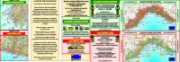
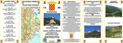
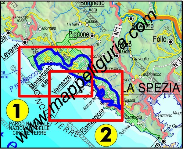
- TrailMAP - SciaccheTrail-2015 - Tavola/Sheet 1
- TrailMAP - SciaccheTrail-2015 - Tavola/Sheet 2
47,7 km - +3120 m -3120 m
SVILUPPO SINTETICO DEL PERCORSO / ROUTE SUMMARY
MATERIALE DISPONIBILE:
In occasione di questa gara, su mia iniziativa e per tutti coloro che desiderano provare il percorso per allenarsi o solo per conoscerlo, ho preparato:
AVAILABLE DOCUMENTS:
For this race, on my own initiative and for all those who want to know the route, I have prepared the following documents:
CARTE DI DETTAGLIO DEL PERCORSO / DETAILED MAPS OF ROUTE
seleziona la tavola da consultare dalla lista o dalla carta sottostante
select the sheet to see from the list or from the map below
Sei interessato a queste carte? Richiedi ulteriori informazioni
Are you interested about these maps? Write me
NOTE:
Tutto il tracciato dello SciaccheTrail-2015, il giorno della gara sara' certamente pulito, percorribile,
segnalato ed indicato in modo oppotuno a cura dell'Organizzazione.
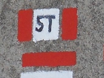
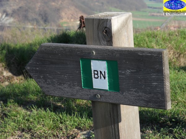
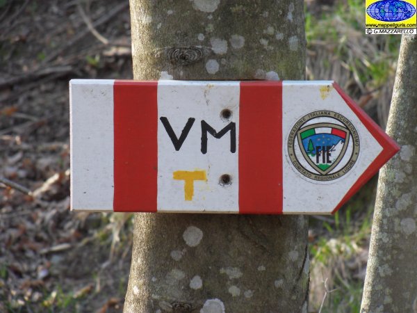
Il percorso transita comunque sui sentieri del PARCO NAZIONALE DELLE CINQUE TERRE,
che normalmente sono ben percorribili e segnalati in modo permanente tramite il segnavia bianco-rosso numerato.
Nonostante cio', al di fuori della data della gara, alcuni tratti di questi sentieri potrebbero presentare
difficolta'/divieto di transito e/o segnavia deteriorato.
Si raccomanda quindi di informarsi sulla percorribilita' dei sentieri sul sito ufficiale del
PARCO NAZIONALE DELLE CINQUE TERRE
Per chi volesse invece effettuare anche solo parte del percorso, al di fuori della data della gara,
e' possibile realizzare facili e relativamente brevi anelli alla portata di tutti,
tramite i tanti sentieri che, partendo dai paesi o dalle frazioni vicine, intersecano il percorso principale.
Tutti questi sentieri sono indicati sia sulle varie Tavole delle carte
Trail MAP dello SciaccheTrail-2015, sia sulle varie Tavole delle
Carte Escursionistiche della collana mMOA che sono:
I dati e le informazioni qui riportate sono relative al percorso dello SciaccheTrail-2015
rilasciato dal sito ufficiale della gara nel febbraio 2015.
Questi dati e informazioni, pur derivando da recenti verifiche sui sentieri dello SciaccheTrail-2015 fatte personalmente,
potrebbero subire variazioni come modifiche del tracciato o modifiche delle postazioni (causate da esigenze organizzative).
Si raccomanda pertanto, il giorno della manifestazione, prima di intraprendere la gara, sia di accertarsi
che non ci siano modifiche tramite la consultazione SITO UFFICIALE DELLA GARA
sia di informarsi al momento della partenza.
Tutto il tracciato dello SciaccheTrail-2015 e' stato percorso dall'autore con un
GPS Garmin Oregon
da cui derivano i dati riportati relativi a distanza, quota e dislivello.
Questi dati, essendo comunque affetti da errori ed imprecisioni dovute a molteplici fattori,
possono differire da quanto riportato sul sito ufficiale della manifestazione.
NOTES:
The race track of SciaccheTrail-2015, the day of the race will certainly clean, viable,
signed and indicated very well by the Organization.
The route travel along the paths of the PARCO NAZIONALE DELLE CINQUE TERRE,
which normally are easily and permanently marked with the trail sign white-red with number.
Despite this, outside of the date of the competition, some sections of these paths may be difficult or interdict and have trail-sign damaged.
It is therefore recommended to inquire about the practicability of the foot-paths on the official website
PARCO NAZIONALE DELLE CINQUE TERRE
For those who wish to travel only part of the route outside the date of the race,
you can make an easy and relatively short rings affordable for everyone, by concatenating
the many paths which, starting from the neighboring villages, intersect the main route.
All these paths are shown both on the various sheets of the maps
Trail MAP of SciaccheTrail-2015, both on the various Sheets of
Hiking Maps type mMOA which are following:
The data and information contained herein are relative to the path of SciaccheTrail-2015
released by the official website of the race in February 2015.
These data and information, although resulting from recent tests on the paths of SciaccheTrail-2015 made personally,
they may change as the track changes or modifications of the manned-stations (caused by organizational needs).
I therefore recommend, on the day of the race, before start the route,
to see the OFFICIAL SITE OF THE RACE
and to ask to the staff before the start.
The entire route of the race was walking path by the author using a
GPS Garmin Oregon
in order to record all the data reported in these pages (distance and altitude)
These data, however, being affected by errors and inaccuracies due to multiple
factors, may differ from those reported on the official website of the event.
