Itinerari TREKKING - Provincia di Savona e di Cuneo
TREKKING routes - Savona and Cuneo district
SV-CN-009 - La "Via dei Feudi Carretteschi"
Tappa/Step 4 - Saliceto - Gottasecca

![]() vai alla tappa precedente / previous step
vai alla tappa precedente / previous step
![]() vai alla tappa seguente / next step
vai alla tappa seguente / next step
NOTE GENERALI / GENERAL NOTES
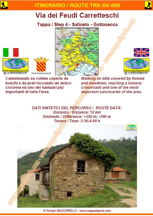
Camminando su colline coperte da boschi e da prati toccando un antico crocevia ed uno dei santuari piuí importanti di tutta líarea delle Langhe
Walking on hills covered by forests and meadows, reaching a historic crossroads and one of the most important sanctuaries of the Langhe.
DATI SINTETICI DEL PERCORSO / ROUTE DATA
Distanza / Distance:12 km
Dislivello / Difference: +350/ -100 m circa/abt.
Tempo / Time: 3:30 - 4:00 h
LOCALITA' DI PARTENZA / STARTING PLACE
Si parte dalla Piazza del municipio di Salicetoo (389m)
Saliceto Ť raggiungibile:
Auto: Autostrada A6 Torino-Savona, uscita Millesimo, proseguire
circa 11 km sulla SP339 in direzione Cengio e poi Saliceto.
Treno: Stazione di Saliceto, proseguire a piedi in direzione
nord verso il centro del paese (20 min; 1,5 km circa).
This step starts from Town Hall Square of Salicetoo (389m)
Saliceto can be reached:
By car: Motorway A6 (Torino-Savona) exit Millesimo, then along main road n.339
towards to Cengio and Saliceto (11 km from motorway)
Train: Saliceto station, walk towards north to the town center (20 min, 1.5 km).
PERIODO / WHEN TO GO
Da inizio primavera ad autunno inoltrato.
Il percorso in inverno potrebbe presentare tratti innevati e/o ghiacciati.
From early spring to late autumn.
In winter, the path may submit traits snowy and / or icy.
DIFFICOLTA' / DIFFICULTIES
Secondo la scala CAI: T-E (Turistica-Escursionistica)
According to CAI scale: T-EE (Turistica-Escursionistica)
INFO E PUNTI DI APPOGGIO / INFO INFORMATION AND ACCOMMODATION
ATTENZIONE:
Questo elenco e' da considerare indicativo in quanto le strutture ricettive con il tempo possono variare (non essere piu' presenti e/o cambiare recapito telefonico).
Prima di iniziare il percorso si raccomanda sempre di verificare sia l'esistenza che la disponibilita' dell'eventuale punto di appoggio.
WARNING:
This list is to be considered indicative, because the accommodation may vary (they may no longer be present and / or change telephone number).
So I recommend everyone to check always both the existence and availability of any accommodation before starting your journey.
- Comune di / Town Hall of Saliceto Tel./Phone 0174.98021
- Comune di / Town Hall of Gottasecca Tel./Phone 0174.906500
Saliceto:
- B&B.............
- Agriturismo/Rooms.........
Gottasecca:
- Ristorante/Restaurant...........
L'elenco, l'indirizzo, il recapito e la descrizione di come raggiungere i punti di pernotto/ristoro Ť presente nel libretto SCHEDA PERCORSO
The list, address, contact details and description of how to reach the accommodation points can be found in the booklet ROAD-BOOK
SCHEDA PERCORSO / ROAD-BOOK
LIBRETTO DI 12 PAGINE CON TUTTI I DATI PER EFFETTUARE L'ITINERARIO
BOOKLET OF 12 PAGES WITH INSIDE ALL INFOMATIONS TO MAKE THE ROUTE
CARTE DI DETTAGLIO / DETAILED MAPS
Questa tappa e' contenuta nelle seguenti tavole della collana mini MAPPE OUTDOOR ACTIVITIES
This step is showed on following mini MAPPE OUTDOOR ACTIVITIES type maps
mMOA-VFC-Tavola/Sheet 07 Tappa/Step 4
Sei interessato alle CARTE DI DETTAGLIO di questo percorso?
CONTATTAMI
Are you interested about DETAILED MAPS of this route?
WRITE ME
QUALCHE FOTO / SOME PICTURES
Lungo il percorso verso Gottasecca
Along the route to Gottasecca
Il Santuario di Gottasecca
Gottasecca Sanctuary
Il Santuario di Gottasecca
Gottasecca Sanctuary
Lungo il percorso verso Gottasecca
Along the route to Gottasecca
La piccola cappella di fronte alla chiesa Parrocchiale di Gottasecca
The small chapel in front of the church of Gottasecca
NOTE /NOTICE
Pur avendo prestato la massima attenzione nella stesura della descrizione del percorso, a causa della mutevolezza del territorio, della variabilita' delle condizioni meteo e di eventuali errori od imprecisioni o giudizi soggettivi indicati nel presente testo, l'autore declina ogni responsabilita' per eventuali incidenti che potrebbero verificarsi. Chi desidera effettuare questo percorso lo fa a proprio rischio e pericolo.
In the description of the route I have done the greatest care, but because of the changing nature of the area, the variability of weather conditions and any errors or inaccuracies or subjective judgments referred to in this text, the author disclaims all responsibility for any accidents that may occur. Those wishing to go this route you do so at your own risk.
Chiunque desiderasse avere maggiori informazioni su questo itinerario, mi
puo' contattare.
Do you want more information about this route?
Please write me








 Dalla Liguria al Piemonte su di un antico percorso tra storia natura e cultura
